I have wanted to do this trail for years and never was able to get the courage to do it or be in the area at the right time weather wise. This year was different. It was my goal hike to start the training season. Although it might have ended up being a little more than I should have done to start, it was still worth it! The trail is incredible and one that anyone who loves to do some epic day hikes or someone wanting to get into backpacking should have on their list, and high up there.

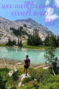
Hike Alice-Toxaway Lake Loop Trail
From its incredible lakes to the towering peaks there isn’t a moment where you will not have something to look at. It really has it all and it even had a small surprise waiting for us!
Miles: AllTrails says 18.86 and it ended up being 19.25 (It ended up 21 miles for us!)
Elevation Gain: 3,400′
Trailhead Elevation: ~6,200′
Parking Lot: Tin Cup Hiker Trailhead – This is a decent size parking lot but nothing bigger than a 20′ van. It is in the campground area so there is a place to turnaround if you end up in the loop. There is probably enough space for about 50 cars. There were also spots along the road before the campground and then of course all the free boondocking in the area. There is also a separate parking lot for horse trailers, with a small car lot right next to it.
Difficulty: Hard
Dogs: Dogs are welcome on a leash.
Time: We did this in a day and with stopping for pictures, chatting with people and a few water breaks, it took us around 9 hours.
Water Safety: There are multiple places to filter water along the way. So either make sure to carry enough or have a filtration system.
Camping: There is camping nearby! That is what added to our mileage but it was so worth being able to camp close to the trailhead.
This post will help you get through the entire loop without making a wrong turn or adding on unnecessary miles. This hike is long enough, to then add on unwanted mile!

Here are the maps that you should definitely take pictures of before you head out. The first is a map of the hiking circuit. There are so many possibilities. It is one of the best in the US. These are at the beginning of the trail, so don’t feel like you need to save these. They are just the ones that you need.

The second is the Alice-Toxaway Lake Loop. You definitely have the option of adding on to the loop, but to make sure you finish the loop in a day, I would focus on just the Alice-Toxaway Loop and not do any of the other lakes. You will see Imogene Lake in this picture. We did this hike on its own and it was beautiful as well. We did it from a different trailhead. You can read about it here if you are interested: Hike Imogene Lake

Let’s get you started! In just under a half mile you will see where you will drop out on your way back. You have the option to go counter clockwise, but I highly suggest going clockwise to get the legs warmed up.

The first time we did this hike we just hiked to Alice Lake, so make sure to check out our post about getting to Alice Lake: Hike to Alice Lake There are a lot of river crossings, waterfalls and beautiful views.
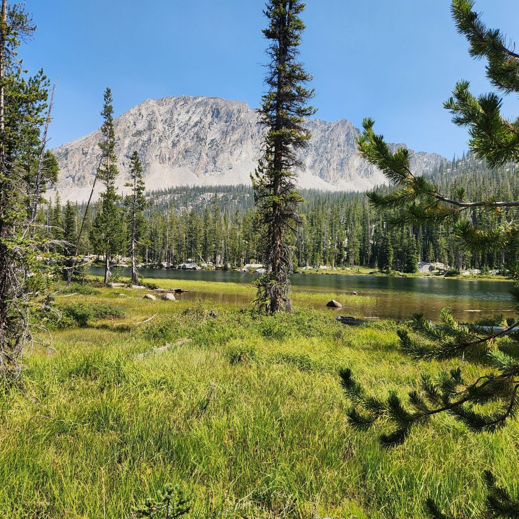
Right before you get to Alice Lake, you will reach a lake that you might think is Alice, but it isn’t. This lake doesn’t actually have a name and so we called it Not Alice Lake. But without a doubt it was beautiful and my favorite on the loop.
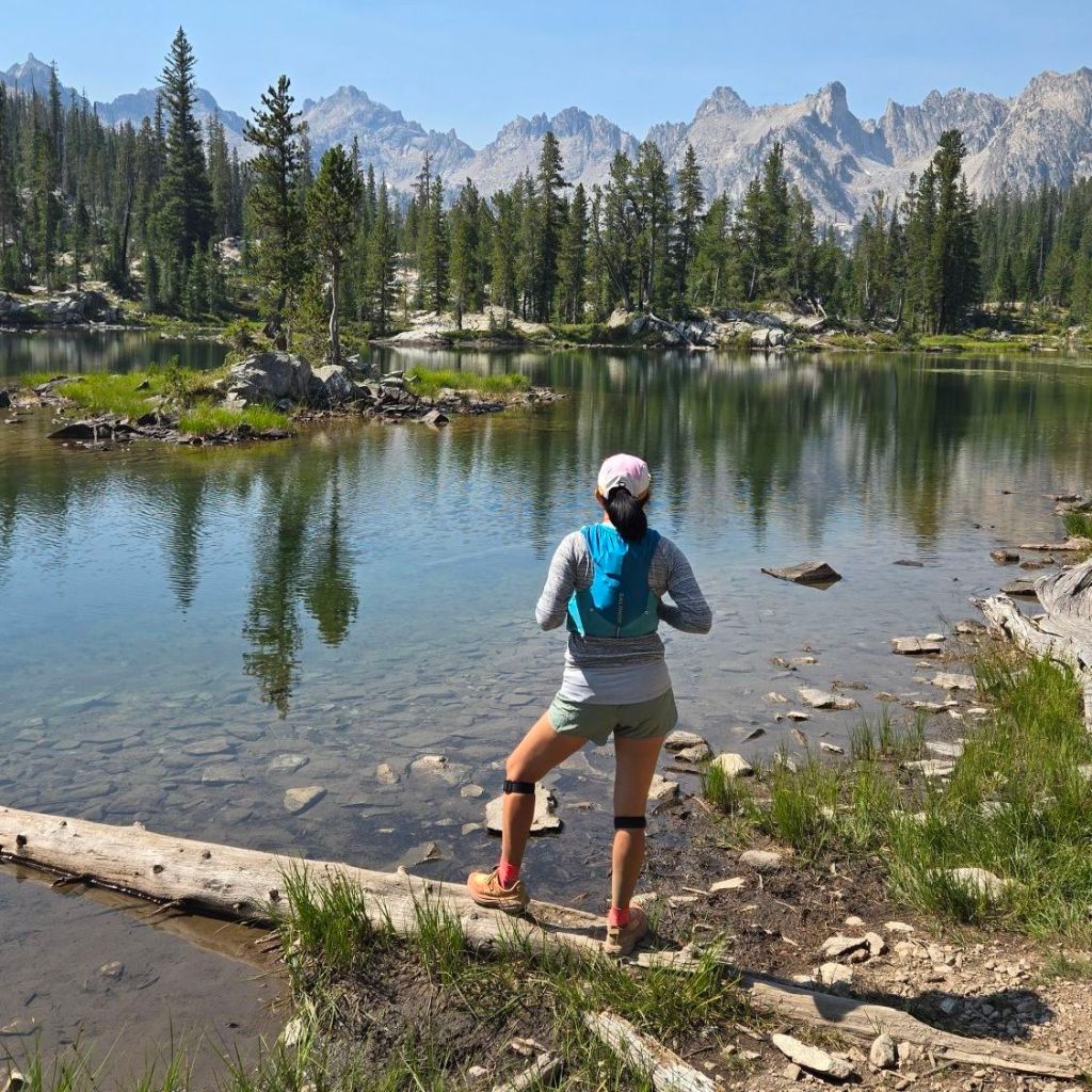
As you will note from the post about Alice Lake you have multiple places to camp and hang out for the day to jump into the water. You will have views of what is considered the El Capitan of the Sawtooths. If you are backpacking Alice Lake is a great place to spend your first night of a backpacking trip. Or a couple nights. But if you decide to head on you will have a gradual incline to Twin Lakes. There is a turnoff to head down to the lake and check it out but we decided to skip it as we were told of a great view as you get higher.
As you get close to hitting the peak of your hike, you are rewarded with a beautiful view of Twin Lakes.
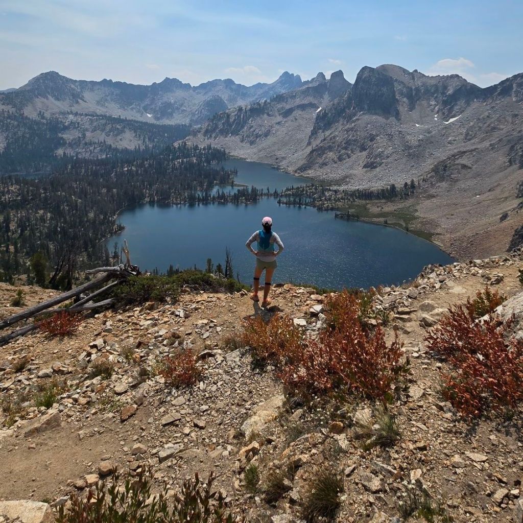
Just over 8 miles, you hit the highest point of the hike! The crest is beautiful with the colored rocks against the mountain backdrop.
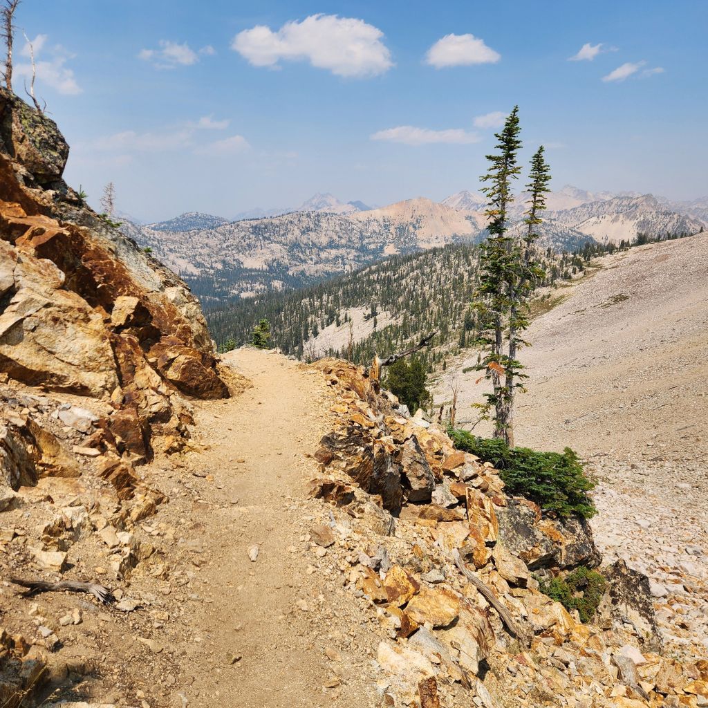
As soon as you turn the corner you have views of the next lake immediately. The trail from here is rocky the entire way down. There is no reprieve so make sure to have good hiking shoes.

You can kind of see from the picture above, but there is a bright emerald lake. This was the surprise! I didn’t realize that Idaho had a bright blue lake like this. The bright blue comes from glacier silt and you will notice that there isn’t a glacier nearby. By the beginning of August there is no snow on the mountains. But somehow there is the brightest blue lake in the middle of a string of lakes!

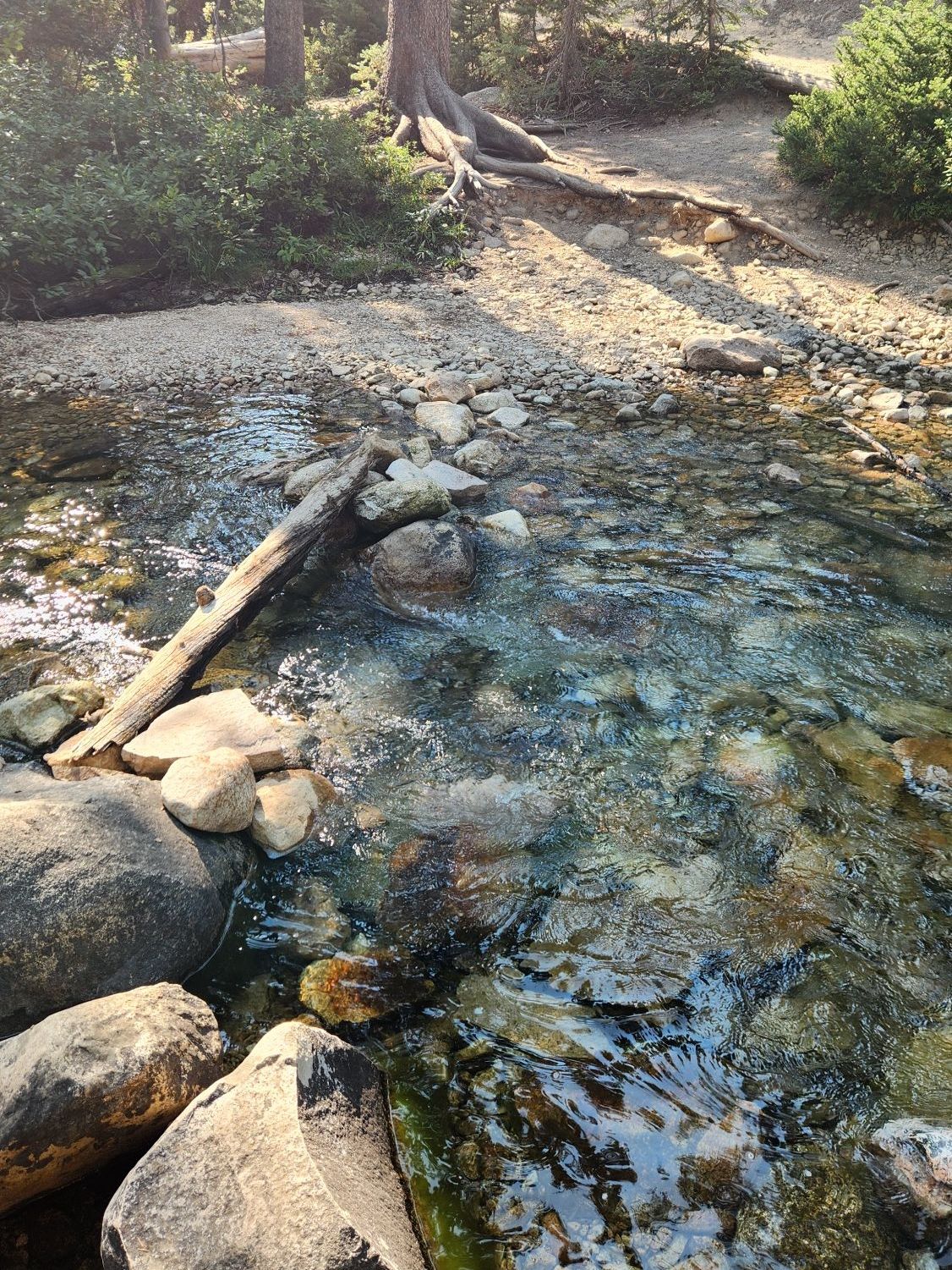
We took some time at the lake before we moved on to find some water. As I mentioned at the beginning, there are multiple places to fill water. The clear water from the streams the entire way are cold and refreshing. There are a lot of options out there of filtration devices and some decide to use iodine drops. We use a Solomon water filter. The cap of our water is the filter so we can fill it with water and then drink right out of it. It is easy to carry and you don’t have to wait for it to filter.

Around 11 miles you will have hit Toxaway lake and will be hiking parallel to it. Toxaway Lake is huge! This is the next great area for backpackers and if you want a break from the hike to relax near the water. The trail stays elevated to the lake and so you will have to find a turnoff to the lake.
Around 11.25 miles you will reach the turn off for Edna Lake. This will add another 4 miles to your hike if you decide to add another lake to your hike. You can also head that way to camp.

We continued on as my knees were getting tired and we still had a long way to go! The last lake is Farley lake and you will reach it around 14.25 miles. We liked this lake better than Toxaway and it reminded us of Not Alice Lake.
Throughout the hike you will have multiple river crossings. This is why it is a great trail for dogs. We were able to make every one of them without getting our feet wet. For some of them it took a bit of balance and careful steps over wet rocks but we did it. On a hot day these water crossing are amazing to dip your hat or if you don’t mind wet feet. Hiking sticks will help a lot in this situation if you have them.
You finally reach the connector trail at 17.25 miles! While you are happy that you have finally reached it, if you have been following your elevation gain, you will realize that this connector trail is a moderate incline, to moderate decline. You will have about 300′ in less than a mile and on tired legs it feels a lot more than 300′.
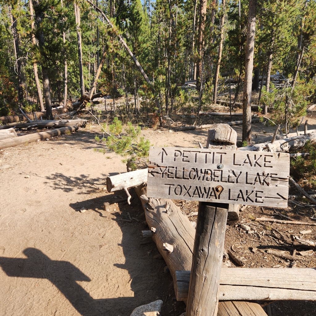
You are getting so close and finally at 18.75 miles you hit that sign from the beginning of the hike!

We finished at 19.25 miles (we still had to hike back to camp)! Take a dip in Pettit Lake! Grab a cold drink and think about what you just accomplished. This is seriously one of the best hikes in Idaho!
Make sure to follow along to see what amazing hikes we find this year!
Love to Pin, use this one!