When we set out to discover our next place to call home, we had multiple things that it had to have. Our list was long and some things could possibly contradict each other, but the main thing was the access to the outdoors.
I sometimes think, “oh, we’ve seen everything here.” Then we plan a hike that we haven’t done and I am blown away by the end result. After seeing some of the most beautiful and unique places in the United States, this area still amazes me.
This hike was no different and quickly became one of my favorite in the area. Hiking Broken Top Trail to No Name Lake with views of Broken Top and endless views of the area made for the perfect afternoon hike.
Hike Broken Top Trail to No Name Lake
Miles: 4.5 R/T ♦ Elevation Gain: 1,100′ ♦ Trail Type: Lollipop Loop ♦ Trail: Moderate/hard
There are two options of where you can start the trail to No Name Lake (see below for coordinates for both parking areas). The first makes it a 15 mile round trip and the second makes for a 4.5 mile round trip. If there is an asterisk by either of these starting points, it would be for the second. It is a high clearance vehicle only from one parking lot to the next. Some parts of the road are single lane with huge ruts.
The other forewarning I would give someone wanting to hike this trail, is the elevation. Make sure to bring plenty of water. Especially if you do this hike in the summer. Two reasons. 1) Elevation is a thing. A lot of people don’t realize how it can affect you. Depending on where you start you can gain up to 3,000′ in elevation and you are starting at 6,150′. Shortness of breath, aches and headaches are common if you are not used to the elevation. 2) A herd of elk unfortunately died due to an avalanche and during this past summer have thawed out right along the lake. A couple have fallen into the water and others have travelled to the spot where you first see the entire lake. This makes the water 100% unsafe for consumption even with all the gadgets.
It is amazing how soon after you leave town you feel like you are in the middle of nowhere. Surrounded by a mixture of beautiful coniferous trees and mountain views, the drive is unique in itself. The first parking lot is just past Mount Bachelor (the ski mountain) at the trail head to Todd Lake. There are quite a few spots here. If you decide to park at the second parking lot, it’s worth a stop before or after to hike around the lake. An easy 2 miles.
If you decide to go on, at your own risk, follow this sign.

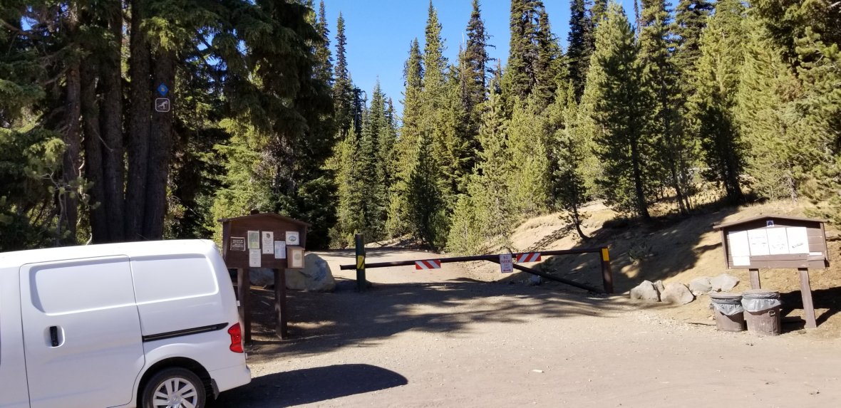
It will take you another 45 minutes to an hour to get to the parking lot. There are small parking areas along the way, but the parking lot you are looking for is at a dead end. So you can’t miss it. During the summer when you get there please make sure to follow signs. People have been parking where it specifically says, “no parking.” Forest fires start this way, destruction of natural habitats and places getting shut down.
This summer was pretty bad with people not respecting these signs, so the rumor that trailheads are going to be shut down, limited or patrolled are true.
After parking, if it is the season, fill out your permit.

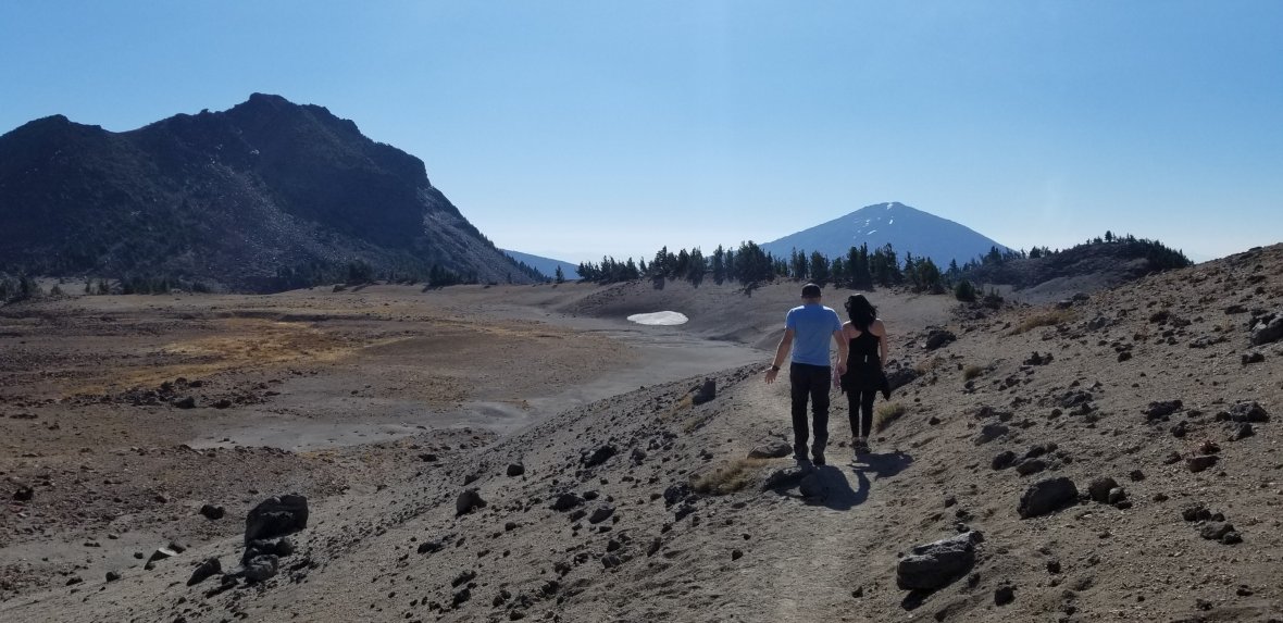
The hike starts with a big view of where you are going.

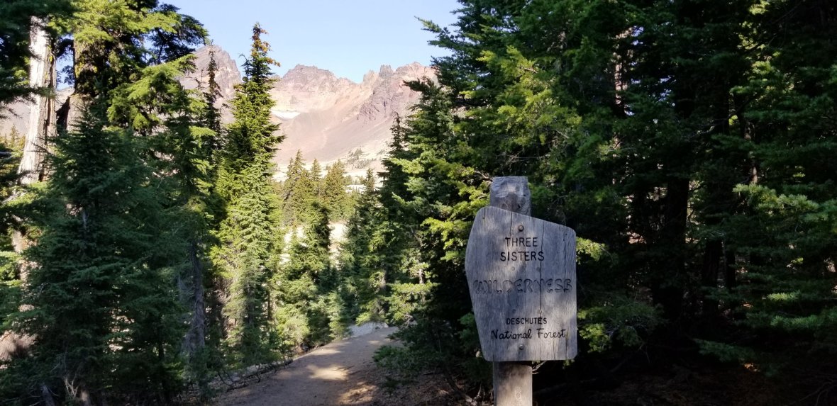
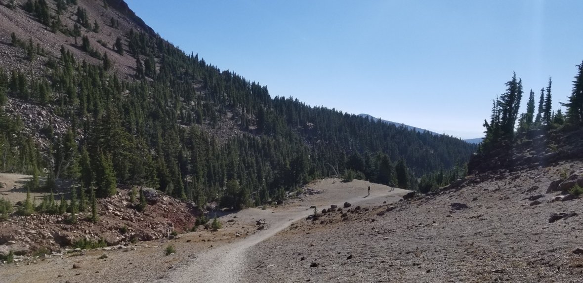
Shortly after you begin your hike, you will come to a forested area and the sign inviting you into Three Sisters Wilderness of Deschutes National Forest.
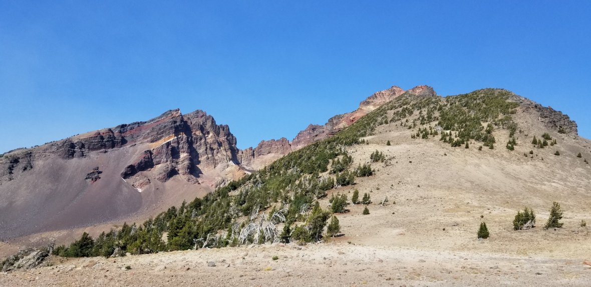
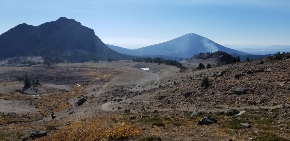
As soon as you come to the clearing, the elevation starts. A serious climb, then you get a break, serious climb and then you get a break… During the break make sure to check out the views. Broken Top is not the only highlight.
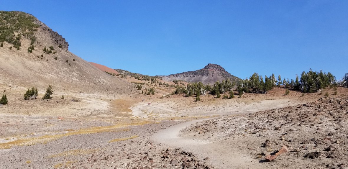
It will feel like it never ends and your destination never gets closer. Keep your eyes on Broken Top and you will eventually get there! Can you see the small people hiking? You keep telling yourself it’s over the next ridge.
As you can see it is very exposed and on a hot day, even at 7,000’+, it gets really hot! There are few shaded spots when you find a cluster of trees, but it is actually quite bare. Again, make sure to bring extra water, especially if you bring a fur friend.
I would say after you get to the third or fourth ridge, stop and take a look back. You can see all the way to Green Lake. Take a moment to see what you have accomplished and how far you have climbed.
The end gets a bit rocky and even in the summer you can come across snow. As you make your final climb, you’ll know you are close. You can see the glacier and the peaks, but you can’t see the bluest of blue waters until you reach it.
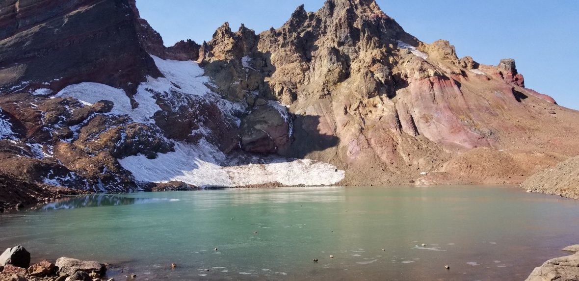
The hike doesn’t have to stop here. If you head to the right you can continue on. Otherwise, stay and relax with a packed lunch or snack. We didn’t smell the elk until the wind picked up. Again, DO NOT drink the water.
The hike back was much easier!
As soon as you get back to the trees you are almost to the end.
Canyon Creek meadows Loop Trail Information
The parking at the second starting spot is small. There are signs that say “no vehicles.” Please respect these signs, especially in the summer. Why? Brush fires and forest fires can start from the heat from under your car starting a fire on all the kindling you are parking on. Let’s respect these signs so people can continue to drive up there, they don’t close it and we don’t burn some of the most beautiful forest we have. This area has been untouched by forest fire, so let’s keep it that way.
Dog Friendly: Yes, on a leash
Family Friendly: Yes
Parking: Two locations: 1) 44.023360, -121.682190 and 2) 44.055939, -121.675366
Parking Fee: More info: Wilderness Pass
Permit: Fill out at trail head
Best Time: Late spring through fall.
Forest: Three Sisters Wilderness in Deschutes National Forest
Other Uses: Trail Running, camping
Access: Season opens in May
USDA Website for Area Status: Broken Top Trail
Love to Pin, Use this one!


