Panther Creek Trail is located in the Chattahoochee Forest of the Chattahoochee-Oconee National Forest in northern Georgia. There were lists upon lists of hikes and amazing things to do in the great outdoors. We read a lot about Panther Creek Trail, about how it is one of the favorite waterfall hikes in the area. The beautiful trail makes 3.5 miles (one way) seem like a breeze, with it’s beautiful creek, trees and moss covered rocks.
Panther Creek Trail
Hike 11/52
Total Miles: 7 ♦ Elevation: N/A ♦ Trail Type: Out and back ♦ Trail Difficulty: Easy (moderate at parts)
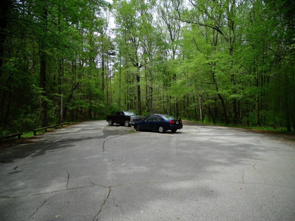
Panther Creek Trail Head
The closest town to Panther Creek Trail Head is Turnerville located on the Historic 441. Park at the Panther Creek Campground. There is a $4/day fee for each car. If it is busy there are a couple spots across the street (where the trail starts).
Coordinates: 34.6984996,-83.4206208
Hiking Panther Creek Trail
When we first arrived, we were the only car! We were a little excited to have the trail to ourselves since we kept hearing how popular of a hike it was. After parking, make your way to the other side of the road from the parking area, the trail head is clearly marked.
")
")
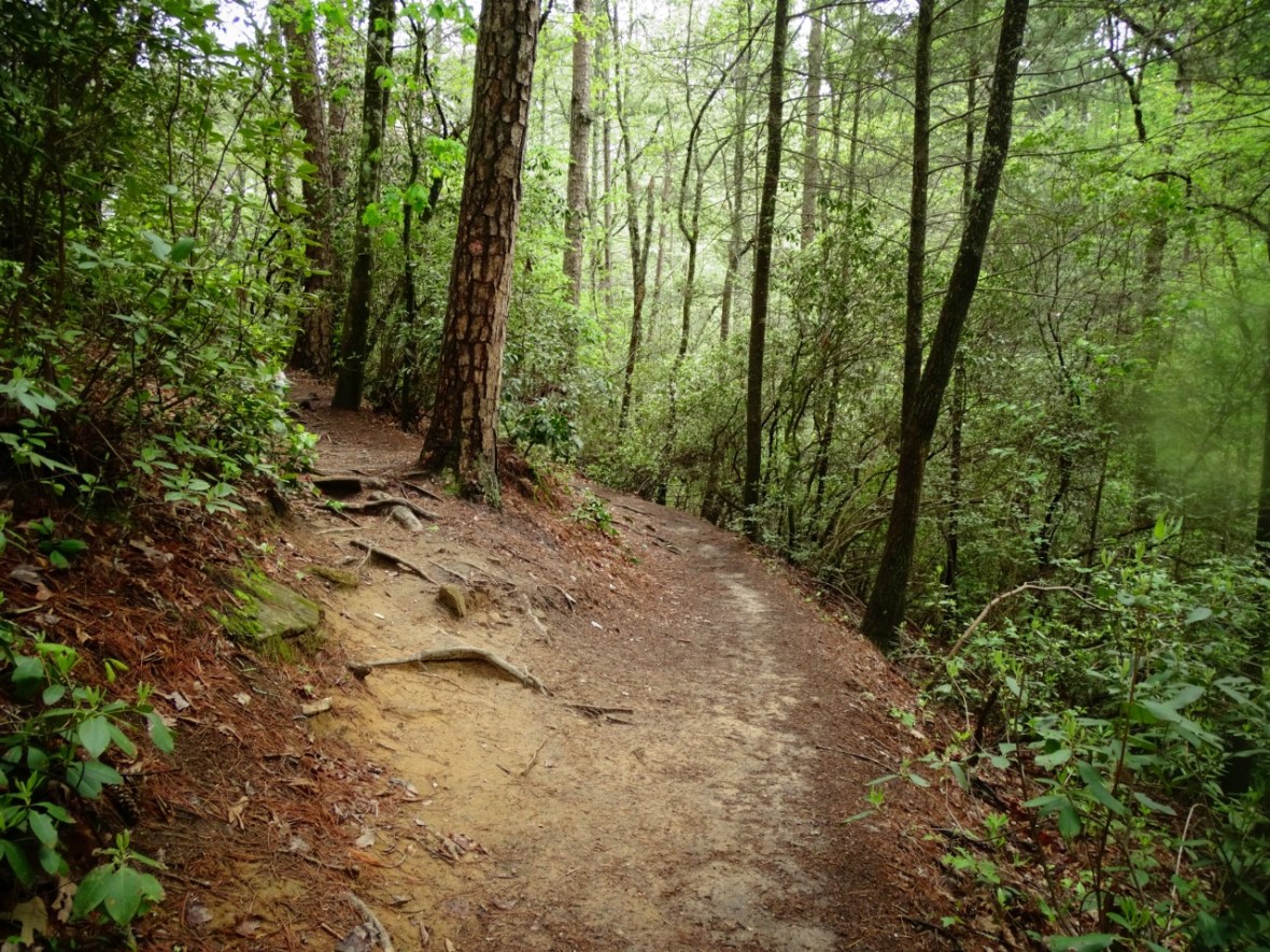
This beautiful hike starts along the creek and through the woods. It was quiet and peaceful. You will pass multiple campsites that are just off the trail close to the creek. The trail here is smooth and well kept. A very enjoyable hike so far!

After a while you will come up to a fun rock jutting over the trail. Unfortunately it had been vandalized, but not enough to ruin the beauty of it.
")
")
Make sure to stop along the way, there are waterfalls and fun swim holes.
All of this within a mile! At this point you have two options (we didn’t know that we had). There is a fork in the trail, which can be easily missed. If you go right (like we did) you will have to climb a steep embankment. If you go left (like we didn’t) then you have an easy walk around to the other side of it.
When we read some reviews on the hike, people mentioned that it was quite dangerous. Up until this point we had no idea what they were talking about. They must not have realized that you can go left here and have a danger free time, but when we went to the right we had the steep climb up slippery tree roots. We read that this was due to weather and heavy trail traffic. They should probably put a closed sign up, but it wasn’t too bad of a climb. If you feel that you are off the trail there are green blazes in the trees quite often, but other than this the trail is very easy to follow.

Once you past this little area it’s smooth sailing for about a mile and a half. There are more camping areas along the way. Perfectly flat, some along the creek and others surrounded by the trees. They were all beautiful spots. Unfortunately the majority of them had trash everywhere. People did not pack out what they packed in. Trash included food waste, wrappers, clothes, tent parts, etc. It was really a bummer and it was distracting.
We tried to look past the garbage and focus on the beautiful scenery. The thick wooded area with spring flowers blooming, it was a good trail to get lost in your thoughts.
")
")
")
")
Then with about 3/4 miles left you reach some areas that can get slippery. They have cables to grab if you need them, but be careful. Not all the cables are secured to the ground. Some are rocks and some are roots. The roots were surprisingly more slippery than the rocks and your feet can get caught in between them! This is probably what the reviews were referring to, but just slow down.
")
")
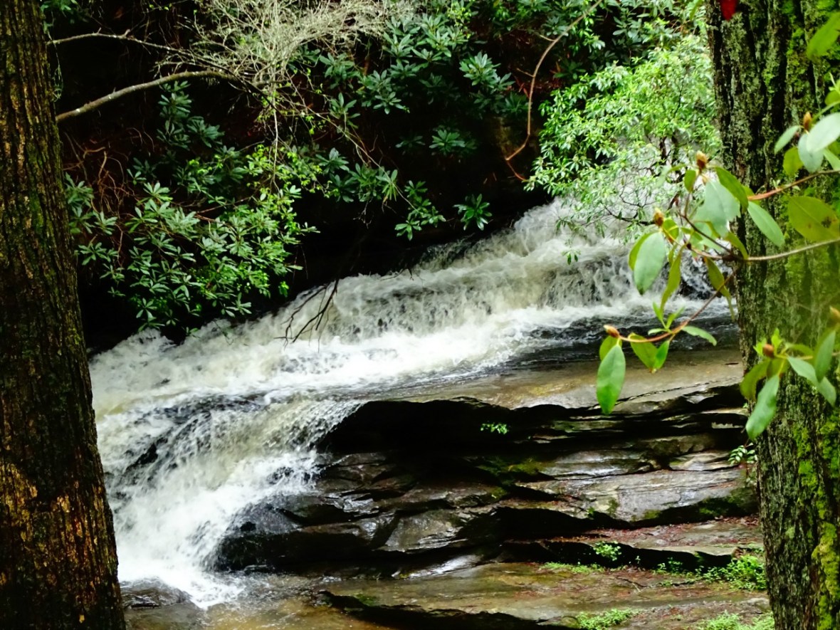
The last climb and around green blaze no. 25 you will reach the waterfall. You can hear it and feel the rumble, but when you see it, it’s amazing!
")
")
We had the entire area to ourselves! It was too cold to swim, but on a hot day in the summer it would be awesome. You can also camp here as well. There is a huge area with fire pits and it’s flat. It was the perfect place for a snack and to relax before we headed back. I don’t know what it is about waterfalls. They are always so soothing and after not seeing too many in California, we can’t get enough of them. This is definitely one of our favorite waterfall hikes!

We did see some creepy crawlers on the hike. Quite a few actually. It made me a bit nervous to ever want to camp here!

These were some of the beautiful spring flowers that were along the trail. I had never seen most of them before today.
")
")
")
")
My favorite were the Mountain Laurel.
")
")
Even with the trash we really enjoyed this hike. We are happy that this exists in northern Georgia and so close to where we were staying. This hike is worth the drive and time. The 7 miles flew by. You could do this hike at any time of day because of the shade the entire time. Still bring enough water and snacks. We would definitely do it again if we were in the area!
I hope that the area can start taking care of the trails more. Even if that means not allowing camping anymore. Nature first, otherwise it might not be there anymore.
Know Before You Go
When we read reviews about this trail the two main things that came up were:
1) There is a lot of trash on this trail. This is true, there was so much trash, that it was distracting and disappointing during the hike. We honestly haven’t been on a trail where the trash was an issue. This trail, on the other hand, was terrible. Probably the worst that I had ever seen. The trash was mainly in the campsites along the trail, including the campsites at the waterfall. There was trash along the trail too. We saw entire bottles of ketchup, mustard and mayo. A backpack full of trash and some toys, a tent rain fly (we actually thought there were campers, but it was abandoned) and clothes. We picked up as much as we could, but it was impossible to get it all. PLEASE LEAVE NO TRACE and respect our public lands.

2) The trail is dangerous and people have fallen because of the slippery rocks and roots. Our experience was that if you take the right way at the fork and walk slowly on the rocks and roots with the cables, that you will be fine. Wear hiking boots or trail running shoes and just be careful. We didn’t fall once or get any scrapes or bruises. Again, there were only a couple places that it got a bit sketchy. The fork in the trail and the couple places that the rocks/roots were steep and wet. We were a little nervous at first but then by the time the hike ended it didn’t seem nearly as bad as some had made it seem. We hiked the trail the day after a rain storm.
Lastly, dogs are allowed on this trail but we did not bring ours. They would have been fine with a little help on some of the rocks, but we were still happy with our decision to leave them at home for this one.
Love to pin? Use this one!


Kim, What breathtaking photographs. You and your husband must be in terrific shape considering all of the hiking you are doing. Take care, Janis FYI – I successfully completed my Missionary License program and I will receive my Missionary License in July 2017.
LikeLiked by 1 person
Congrat Janis!!! So proud of you!
LikeLike
beautiful hike and what beautiful pictures! love the waterfalls and all the green trees 🙂
LikeLiked by 1 person
We were pleasantly surprised with it! Highly recommend.
LikeLiked by 1 person
This was great to reead
LikeLiked by 1 person
Thank you!
LikeLike