Why do most people travel to Sedona? Because of the intense beauty it has to offer. People who love the outdoors will get more than they can handle in a weekend or week vacation. Full time nomads don’t experience everything it has to offer! This was our second time in Sedona and it totaled to just over 3 weeks and we still missed a lot!
We were happy to be able to make it back to the area and as always we try and find the best hikes, the hikes not to miss. It can be hard though, when you search online for hikes you will no doubt come across a huge lists of trails and destinations. The best part about that is you have options depending on what kind of hiker you are. If you like a leisurely long walk through nature, destination hikes or hard climbs, this place has it all. Because of this variety you also get the variety in landscapes all within a short distance of town.
So after further research here are the two hikes we did this time and a couple others for you to try!
Hikes in Sedona
Hiking Soldiers Pass Trail
Hike 17/52 in our challenge
Miles: 6 ♦ Elevation: 1,200′ ♦ Trail Type: Out and Back ♦ Trail Difficulty: easy to moderate
We chose this trail because of the chance to find the secret cave. Plus the trail has multiple landmarks along the way and beautiful views from the top. After leaving the parking lot, you will feel as though you had just gotten into a groove when you arrive at the first stop. Devil’s Kitchen Sinkhole is at about .25 miles and is worthy of a stop. This sinkhole was created when the cave originally collapsed in the 1880s. The most recent collapse, 1989.
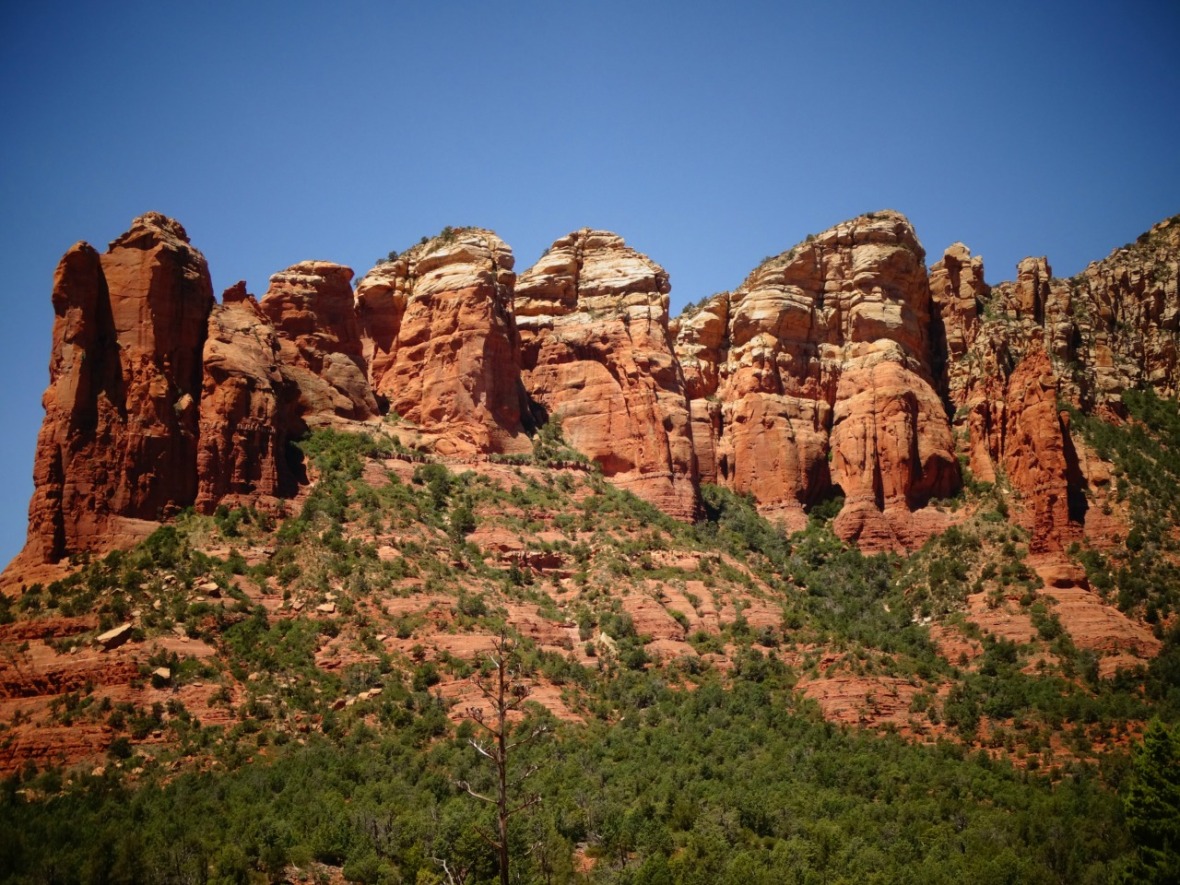
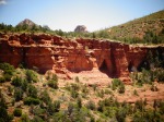
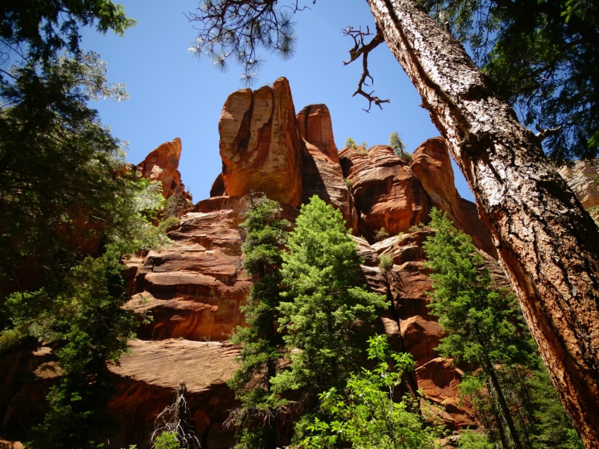
Continuing on you are immediately hit with the views that you can see throughout the trail. Be careful not trip as you look around, because it’s sometimes hard to stop looking up. The beautiful red rocks are so bold against the blue sky. We never tired from seeing them and they always looked different depending on where you were at on the trail.
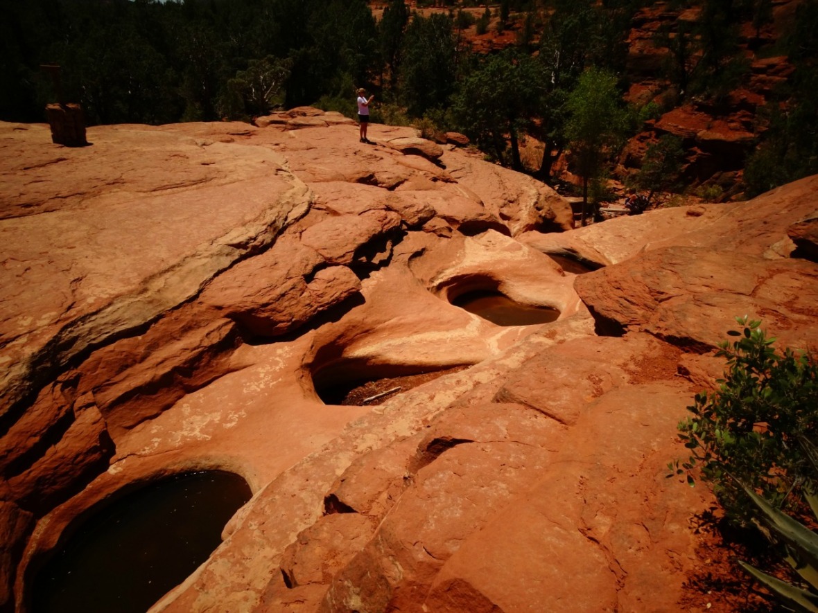
After the sink hole, hike about another .25 and you will arrive at the Seven Sacred Pools. A little dry already in May, the rock formation is the highlight. This area can get quite busy because it is a stop on the jeep tours. They will come up and park pretty close to the pools and then are guided to the sink hole.
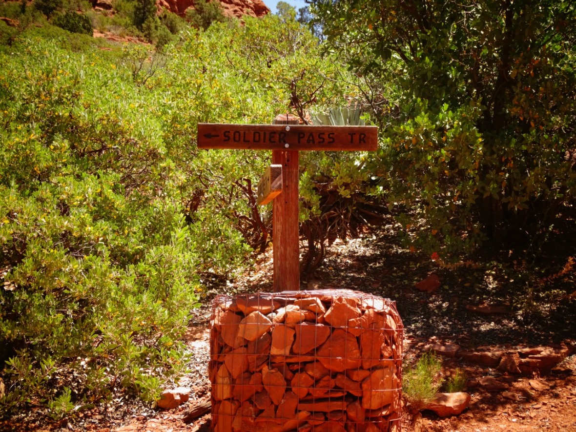
The trail is very well marked. There were signs and cairns, but in most places you didn’t need them.
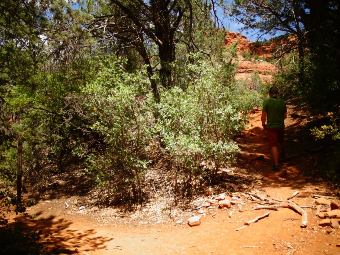
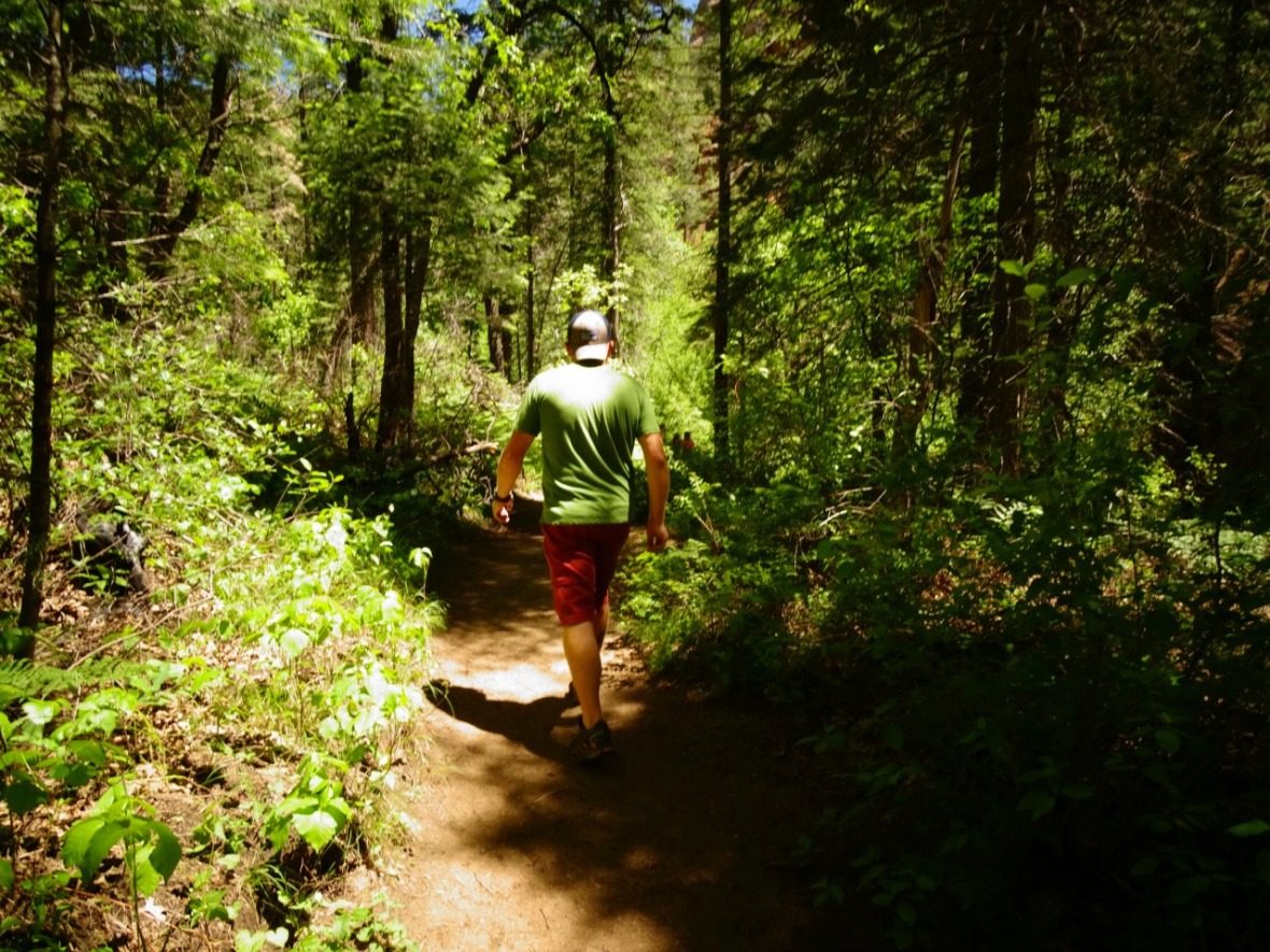
The hike continues through beautiful trees for a little shade and up and down boulders. Around a mile and a half in the climb to the top starts and at Sedona elevation, can be a bit tough. Sedona sits at around 4,300′ so don’t try and just run up if you are not used to the elevation.

At the top the trail hits Brin Mesa Trail. If you head to the left it will lead you to Dry Creek Road. The trail head for Devil’s Bridge is south of there. If you head to the right, you walk along the rim and can make the hike a loop back to the parking lot. Off of Brin Mesa Trail take a right on Cibola Pass Trail, a right on Jordan Pass Trail, left on Sink Hole Trail and then that will lead you back to Soldier Pass Trail. Doing the loop makes it around a 6 mile hike instead of a 4 mile down and back.

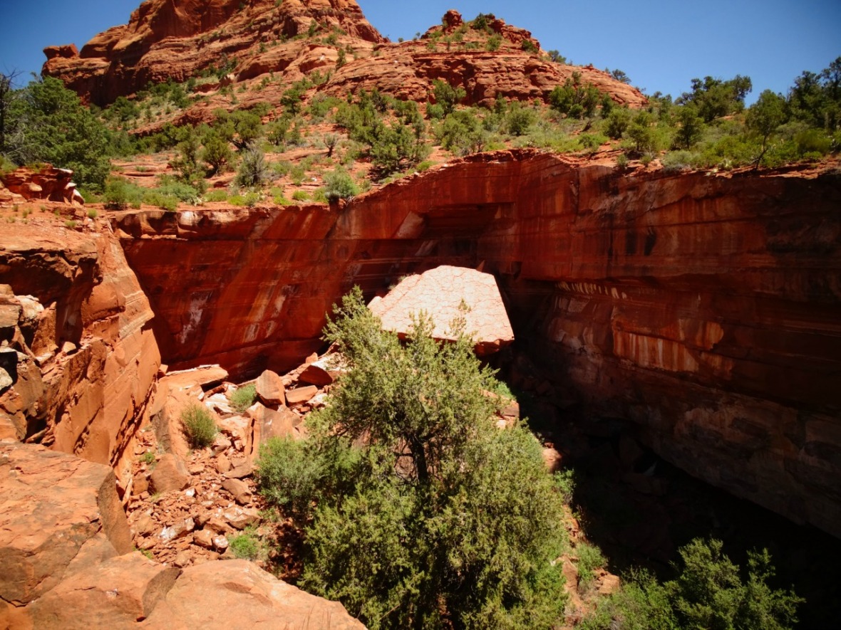
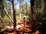
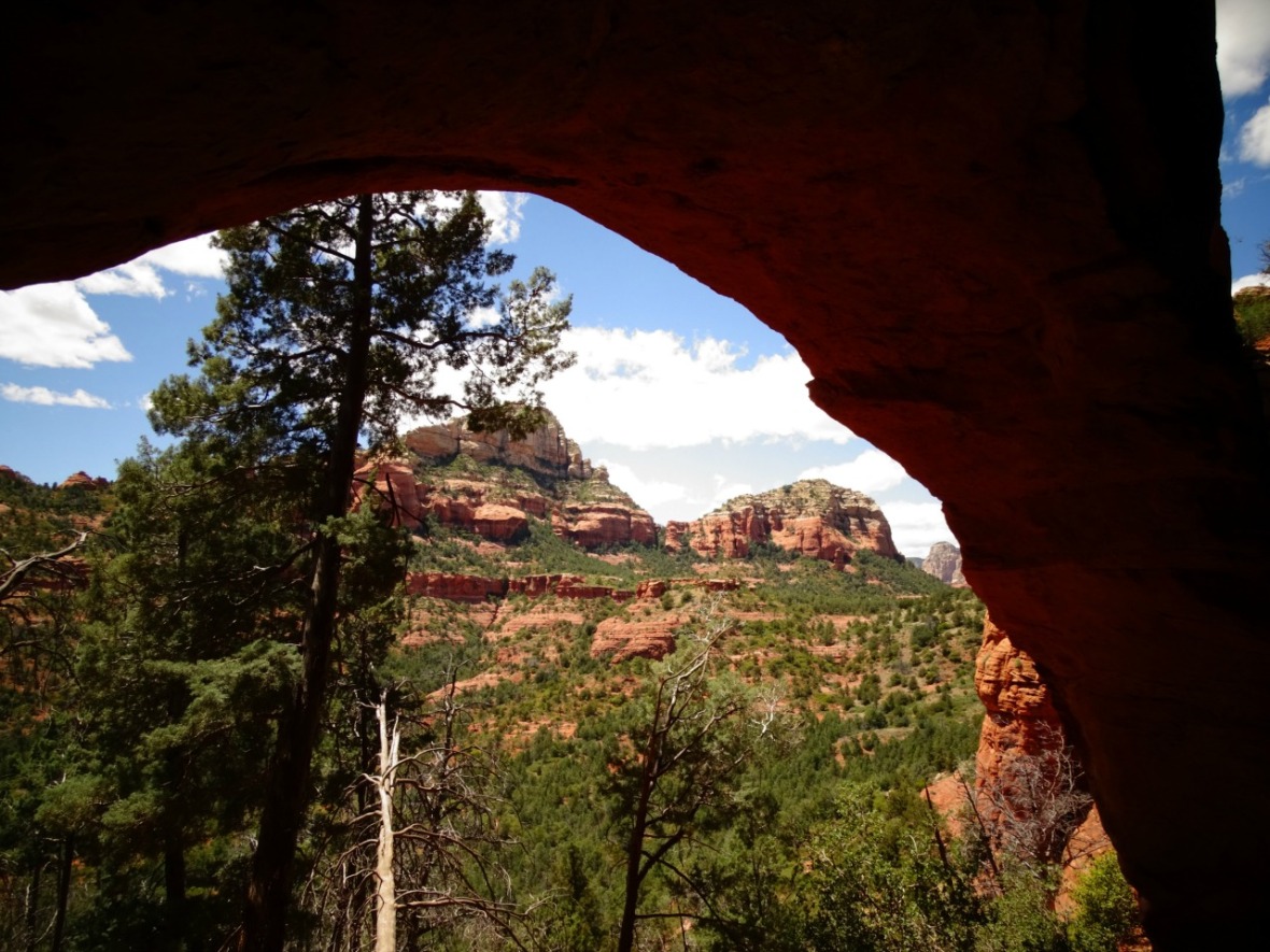
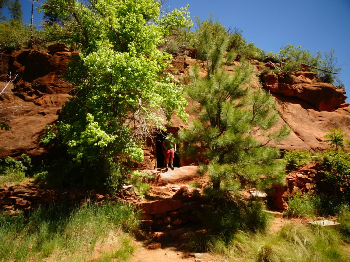
Instead of doing a loop, we headed back to try and find the secret cave everyone was talking about. It was an easy hike down and we had to skid to a stop to make the turn. During the hike you can actually see the cave from the trail, but there is only one safe way to get to it. After seeing it, it’s just figuring out how to get there. Look for a sharp turn towards the cave on the main trail.
It’s a pretty steep climb to the cave, but not long. The trail is not marked in some areas so just keep your eye on the prize (hint: stay to the left).
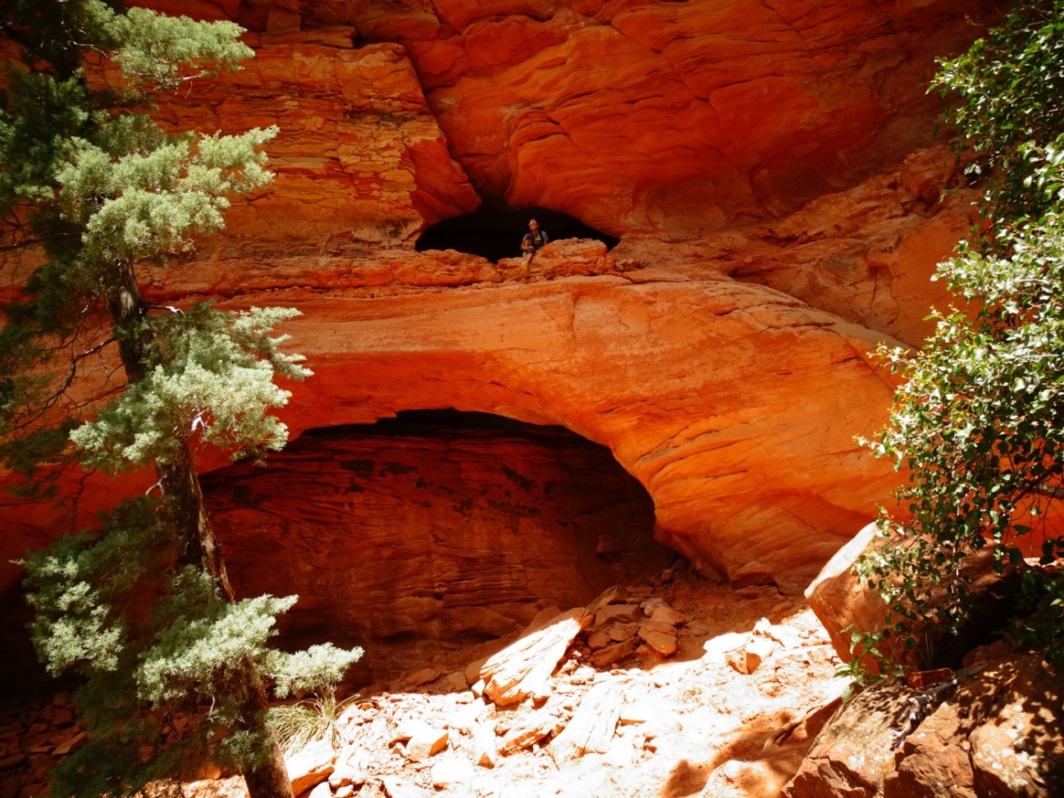
After getting to the cave be very careful getting into it. You have to scramble up some rocks or make a very sharp turn into the cave from a narrow ledge. Either way, it’s worth it and getting down is the easy part.

It was better than expected and we spent almost an hour inside. It was a cool reprieve from the sun and we met a couple other fellow hikers that made it. It was nice that it wasn’t as busy as the trail. The colors of the rocks changed depending on where the sun could get in.


The view from the cave is not to shabby either.
I should mention that you should not forget to look down as well. In May the cactus flowers were in full bloom!

Getting to and Parking at Soldier Pass Trail
Parking was a bit of an issue for this trail. The actual parking lot is made for only 14 cars and one handicapped spot. You cannot create your own spot or park along the road. We saw cars just parking in the neighborhood that were ticketed. We arrived at around 10:00 a.m. and it was full (10 minutes earlier and we would have had a spot!). We waited for a bit and then decided to try and get to the Brin Mesa Trail Head by Devil’s Bridge. We thought we could park at the trail head, but WARNING that is not correct. You have a long walk from Devil’s Bridge Trail Head first and a bit of walk to Devil’s Bridge Trail Head to start. This was just getting crazy. The parking lot there was full, the sides of the road were full, the parking lot from Mescal Trail Head to Devil’s Bridge Trail head was also full. The road that you have to walk to get to Devil’s Bridge or if you make the trek to Brin Mesa Trail is the same road as the jeep tours and 4x4s, so you are getting blasted with dust. What we should have done was try Jordan Road Trail Head, but we honestly didn’t know about it. When I went there another day to run the Jordan Trail it was almost empty, but there is a fee. This would be a part of making the trail a loop starting from a different location. You won’t miss anything if you do have to park here. So I guess, the best advice: get there early!
Here are all your parking possibilities, starting from easiest to hardest. We ended up getting a spot at the actual trail head for Soldier Pass Trail around 11:00 a.m.
Soldier Pass Trail Head Parking: 34.884157, -111.783766 Some people do use this parking lot just to go to the Seven Sacred Pools, so definitely do wait for just a minute if you can.
Jordan Trail Head Parking: The entrance is off of W Park Ridge Drive. 34.887689, -111.768150 From this parking lot you can get to the trail head for Jordan Trail, Cibola Pass Trail and Brin Mesa Trail. If you head left on Cibola Pass Trail this will take you to the beginning of Soldiers Pass. If you take the Brin Mesa Trail, then you will walk the rim and then have the easy hike down Soldiers Pass back to Cibola. You can also do something completely different and take Jim Thompson Trail.
Devil’s Bridge Trail Head Parking: The “actual” parking lot is for off road vehicles and jeeps that are allowed on Dry Creek Road. Otherwise you do need to park farther down the road in another parking lot or on the main road and walk the gravel road up. Here is the coordinates for the turn you make off of Dry Creek Road. 34.887719, -111.822633 From this point to Brin Mesa Trail is 2.5 miles along the road.
Mescal Trail Head Parking: 34.901786, -111.826906 Take the Mescal Trail to Chuck Wagon Trail and when you see the trail head for Devil’s Bridge take a left on the service road for a long walk (2.5 miles). I would really make this a last resort.
The only trail head with a fee is Jordan Trail.
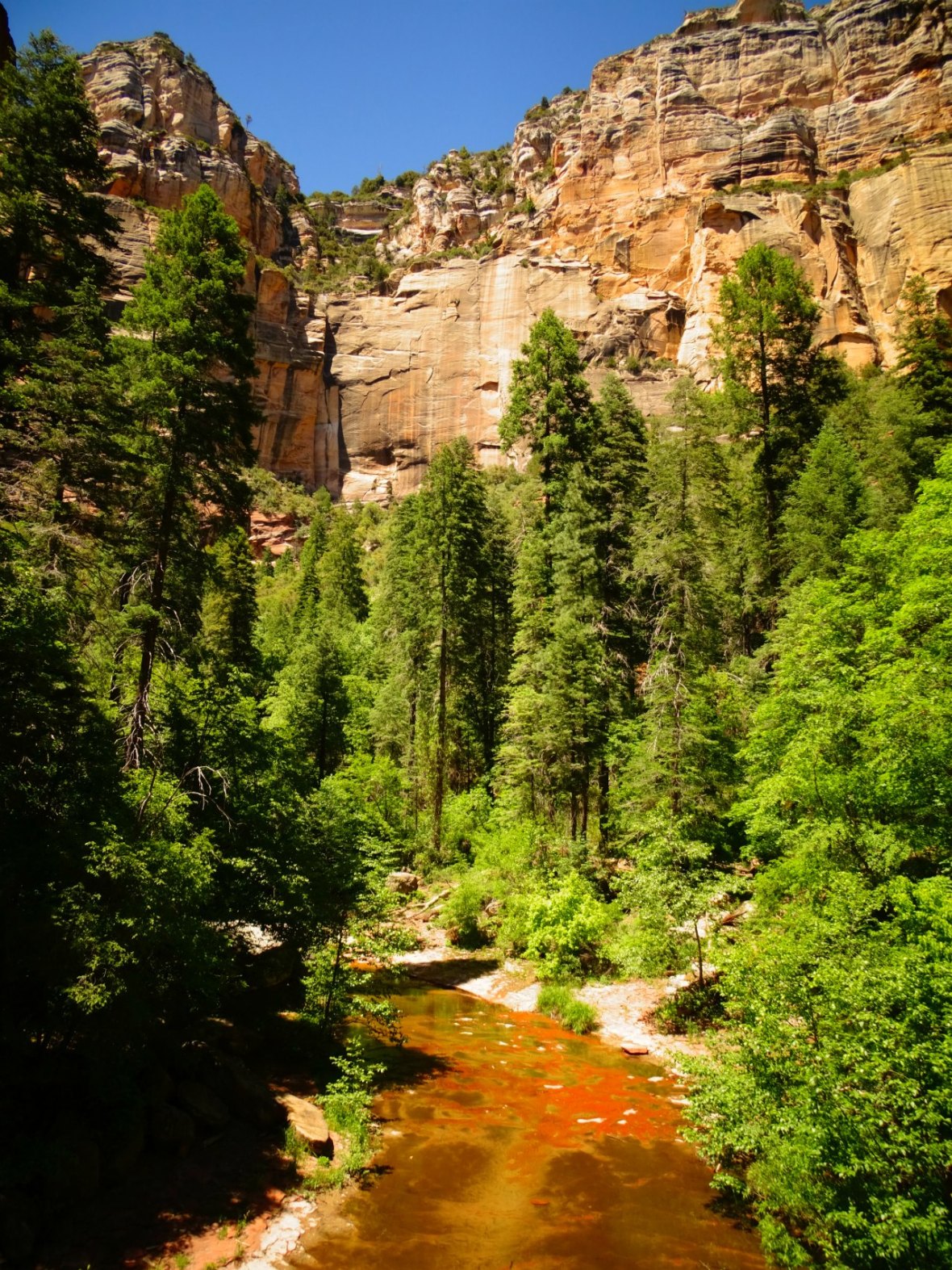
Hike West Fork Trail
Hike 18/52 in our challenge
Miles: 8 ♦ Elevation: 10′ ♦ Trail Type: Out and Back ♦ Trail Difficulty: easy
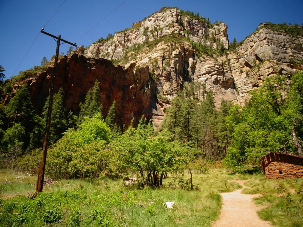
This trail was PACKED! It’s a short drive north of Sedona on beautiful 89A. It is busy due to how easy it is to hike and access. There is pretty much no elevation change and most of it is shaded and it’s dog friendly and family friendly. We still wanted to check it out because we were with friends and there was supposed to be a beautiful destination at the end. Most articles you read about this will say it’s a 6.6 mile hike, but it’s actually 8 miles. From the parking lot there is a .7 walk to the actual start of the trail (That doesn’t include if you go further down the wash or if you can’t park in the lot because it’s full. We had to park .5 miles up 89A. More below).
From the parking lot you have the easiest part of the hike to the actual trail head. Past majestic cliffs and a couple old buildings it will feel like a breeze on the manicured path.
When you reach the trail head make sure to read the signs right there. From here you will then have 3.3 miles to go and they say 13 creek crossings. We were able to stay dry, but if I had my water sandals it would have the perfect temperature to just walk through. All the crossings were no deeper than mid calf on me.
")
")
This is a great trail to bring a dog because of the shade an ample water, it’s a dream for them.
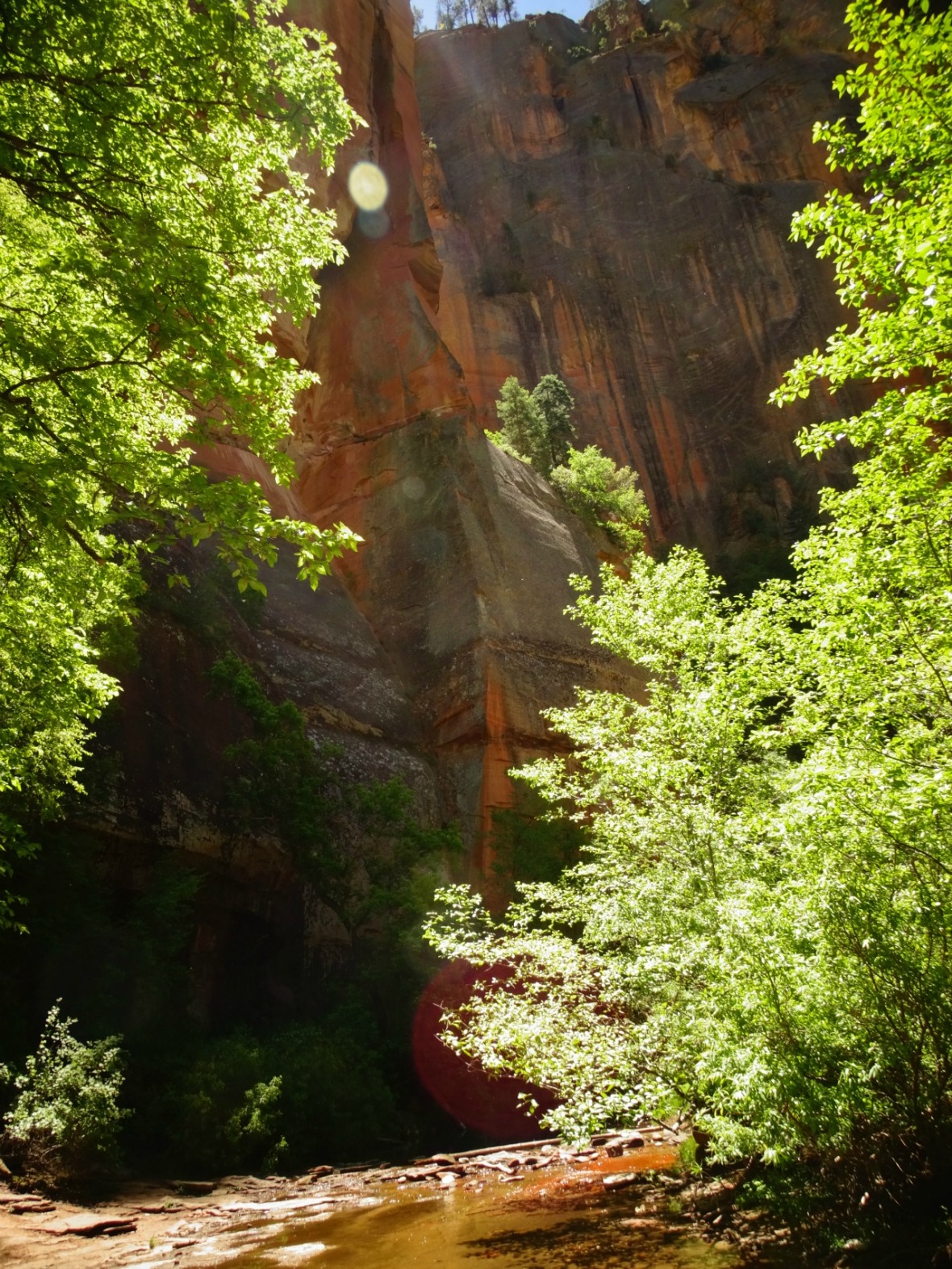
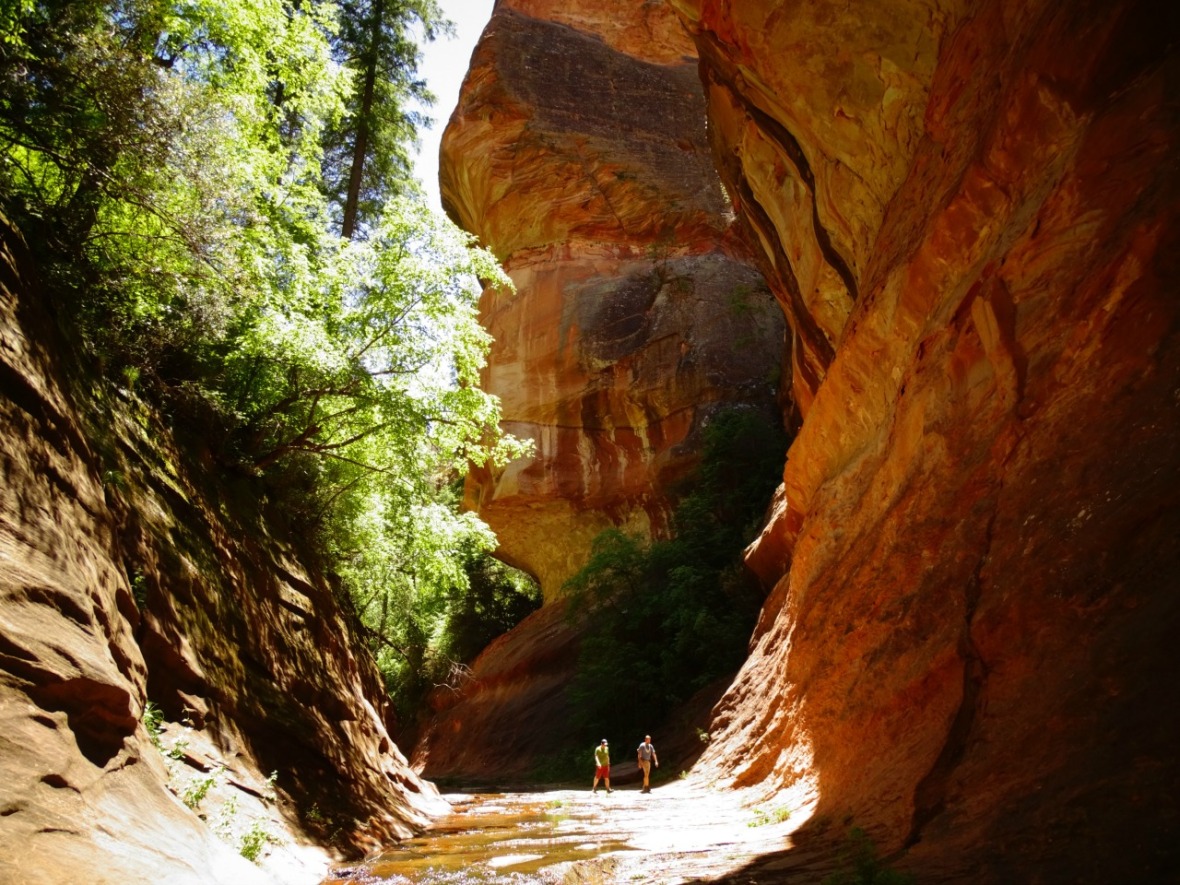
You are walking through a canyon so not a lot of sun is able to get through, which also means there are amazing high cliffs all around you. It was hard to capture the massive sizes and the actual beauty, but we tried. It was truly incredible.
There were multiple stopping points along the way for playing in the water, exploring crazy rock formations or just breathing in that fresh air. We love hiking and it’s especially awesome when we have friends join us.
")
")
Shenanigans and fun times are sure to be had! Just one more of the views before we head to the destination!
At the end it felt like a mini Narrows (Zion) into a huge canyon. We walked a little farther down and it was beautiful. You probably will get wet here unless you are fiercely fast on your feet and agile!
")
")
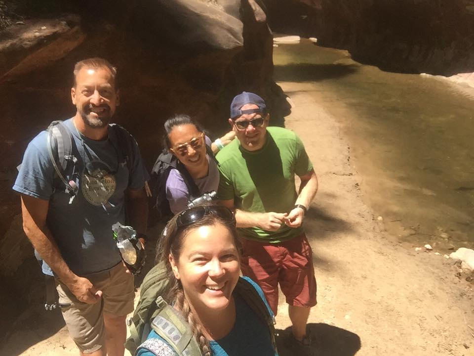
We got a fun selfie from our hiking friends! http://www.wanderwasi.com
If you do have time, continue past the water and around the bend to the beautiful high rock walls.
The hike on the way back will feel a bit different. You will see the views at a different angle and with the sun hitting it at a different spot. I think we ended up stopping more on the way back!
Parking for West Fork Trail
There is a designated parking lot for this trail. Coordinates: 34.990214, -111.741655
There is a fee at this parking lot. $10/car to drive in or $2/person to walk in. Cash or check only. The Big Three Pass or Grand Annual Red Rock Pass will get you in for free. The Access Interagency Pass will get you in for 50% off, which they honor to each person in the group.
We got there late morning and the parking lot was full with a line of cars waiting. So we followed suit with the rest of the cars that drive up the road and find safe parking along 89A. We didn’t find a spot until .5 miles up the road and then had the very interesting walk back to the parking lot. Most (not all) people driving in the area know that there will be a lot of people on the road (or should be able to figure it out quickly). Again, most people shouldn’t be driving fast either because the road is lined with cars and it’s a curvy road. Just a disclaimer to be very careful.
Other Hikes We Did In The Area
Bell Rock – You have options at Bell Rock. The parking lot is at: 34.805133, -111.767516. There is a parking fee (I am not sure of any discounts) and the parking lot can fill up quickly.
Bell Rock Access Trail is only .75 and lets you climb, not hike, up Bell Rock. We didn’t get to the top, but I think some got pretty close.
Bell Rock Trail meets up with Courthouse Butte Loop Trail for just under a 4 mile hike.
There are so many trails right here that you can really make it your own.
Devil’s Bridge – This trail is extremely busy. It’s only a 4.4 mile RT (down and back) hike with 600′ in elevation change. If you are lucky you will get some time on the bridge. Other times you will wait in line and hand off your camera so someone can take a picture. Reminder that 4.4 is from the trail head that most are not allowed to park at.
Here is the information from above: The “actual” parking lot is for off road vehicles and jeeps that are allowed on the road. Otherwise you do need to park farther down the road at another parking lot or just before the turn off and walk up the road. You can park here or make the turn and attempt to find parking at the other lot: 34.887719, -111.822633 Either way you will have to walk up the road that 4×4 and jeeps drive up blasting you with dust!
Mescal Trail Head Parking is another option. It adds a couple miles to the overall hike, but it’s very easy. The trail head parking is at 34.901786, -111.826906. Take the Mescal Trail to Chuck Wagon Trail and it takes you directly to the trail head for Devil’s Bridge Trail.
Slide Rock – This is actually a state park. Located north of Sedona on 89A is very very popular. There is a fee to park and enter so remember some cash. Even in May we saw people set up along the rocks for the day along the slide. Cool or hot people are always wanting to take a turn on the slide. You can read about our time here: Slide Rock State Park
Address: 6871 N. Highway 89A, Sedona, AZ 86336
Care for a trail run?
This was the only trail run I did and I really liked it! I was still getting used to the elevation and so I didn’t do any technical runs, but they are definitely here in the area.
Jordan’s Trail – Park at the trail head: 34.887689, -111.768150 This is a great place to start for a trail run. We actually parked 34.871147, -111.761098 and I ran up Jordan Road to W. Park Ridge Rd. That was tough but it added to the run, free parking and gave me a down hill on the way back!
Jordan’s Trail is an easy and beautiful run and it meets up with multiple trails. One of them is Javelina Trail that runs east and descends back towards 89A. Otherwise Jordan’s trail ends just before Devil’s sinkhole. One way it’s only 1.5 miles but you can make awesome loops if you don’t mind running on 89A or more difficult trails.
![IMG_20170519_121032_532[1]](https://33andfree.live/wp-content/uploads/2017/06/img_20170519_121032_5321.jpg?w=1180)
The hike that we missed and that will have to wait for our third trip: Fay Canyon!

Reminder: We are all guests, please pack out what you pack in and remember trail etiquette!
What was your favorite hike in the area?
Love to pin? Use this one!


You should create a color coffee table book (I think I may have already told you this). The pictures are stunning. Janis Nelson, Chairwoman & CEOThe Disciples’ Theatre Ministry LLCEvangelistMissionaryThe Church of God in Christ, Inc.Office: (310) 922-9347 Email: msjanisnelson@att.net
LikeLiked by 1 person
Thanks Janis! We are thinking about it!!
LikeLike
Thanks for the great article! I’m going to visit Sedona later this year and love to hike so this was super helpful!
LikeLiked by 1 person
You will have such a great time! I hope you are able to do some of these. Let me know if you did and if you found any other great ones for us to try next time. Thank you!
LikeLike
I was hiking in Sedona several years ago with family, and I THOROUGHLY enjoyed it just like you. It is truly a strangely intensely beautiful place. Lots of great tips here for where to hike and how to do it, which is helpful – Sedona has so much to offer it can be overwhelming! Thanks for sharing!
LikeLike
WOW, awesome pics and very helpful tips. I’ll try to make it when I’m in Arizona ! Thank you !
LikeLiked by 1 person
Thank you and you are welcome! There is so much to do there. It’s absolutely beautiful. Enjoy!
LikeLike