As I was doing research for a hike close to Ketchum, multiple trails came up closer to Stanley, Idaho (which is about an hour away from Ketchum). We planned to meet friends up in the area to view the eclipse so we decided to go early to get in as much of the hikes as we could.
The first hike we decided on was to Goat Lake. We were warned by multiple people that we would get lost on this hike and you should not do it. They said that the trail was hard to find and that it isn’t a good hike. Well, us and friends of ours were determined to reach this beautiful lake. We both did research and looked at maps and both came to the conclusion that we could make it! There isn’t a lot about this lake out there, so the information here is all you need. Don’t read the book that is floating around out there because it doesn’t seem to be accurate. We had to give the unfortunate news to a couple of ladies that if you wanted to make it to the lake and get close to the falls you needed to be able to rock scramble and make a steep climb. Other than that, all you need to make it is a couple directions and some hiking common sense. We definitely needed the directions because there were multiple junctions along the way and the point you start to really climb is unmarked.
Don’t be discouraged, it’s a beautiful hike, a beautiful lake and worth every step.
Hike to Goat Lake
Hike 35/52 in our Challenge!
Miles: 8.7 ♦ Elevation Change : 2,484” ♦ Trail Type: Out and Back ♦ Trail: Moderate to Hard

The couple of websites out there that have any information on this hike say it’s a 6.8 out and back trail. According to my watch that was incorrect. If you want to make it all the way to the lake it’s at least 8.4 miles. The discrepancy comes with how you scramble over the rocks to get to the lake.
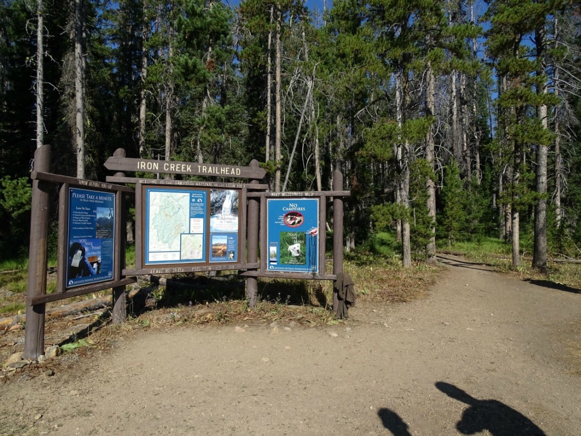
Let’s start at the beginning though. The hike to Goat Lake starts at the Iron Creek Trail Head. This trail head is also the start for the hike to Alpine and Sawtooth Lake. Both lakes are very popular for day hikes and overnight camping. There is a decent size parking lot for vehicles up to van size, if you get there early enough you will have no problems finding a spot. There are also campgrounds along the way. Fill out the free permit (Try and do as many permits as you can. A ranger said they get funding depending upon how many permits are filled out.) before you start your hike.
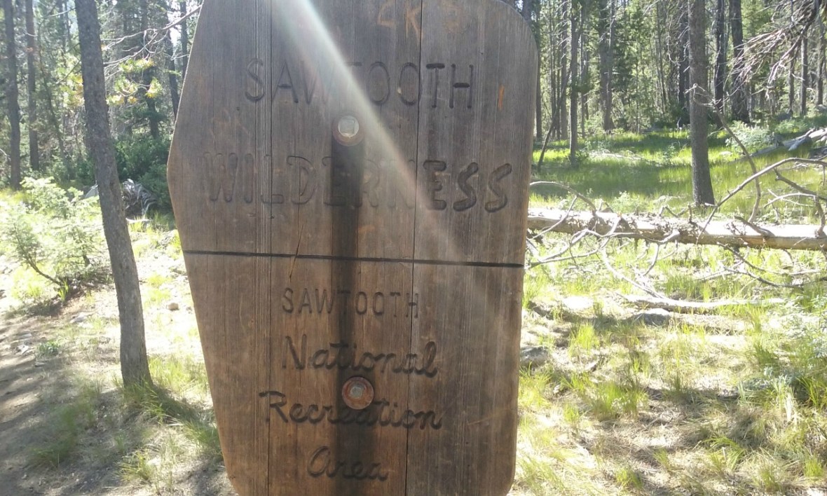
The hike starts as an easy walk through the forest. It’s absolutely beautiful. You will hit the National Forest after about 1.1 miles.
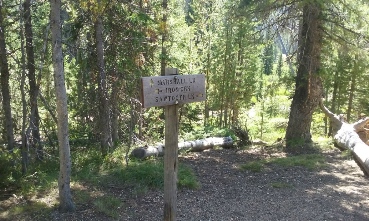
The hike continues to be an easy walk along the stream, but soon after this sign you will see another. To head to goat lake, take a left.
Your first creek crossing comes just after this sign. The water is so clear that you can barely see it. It’s not a hard crossing, but you will have to balance on a couple logs. Don’t forget to check out the view as well.
")
")
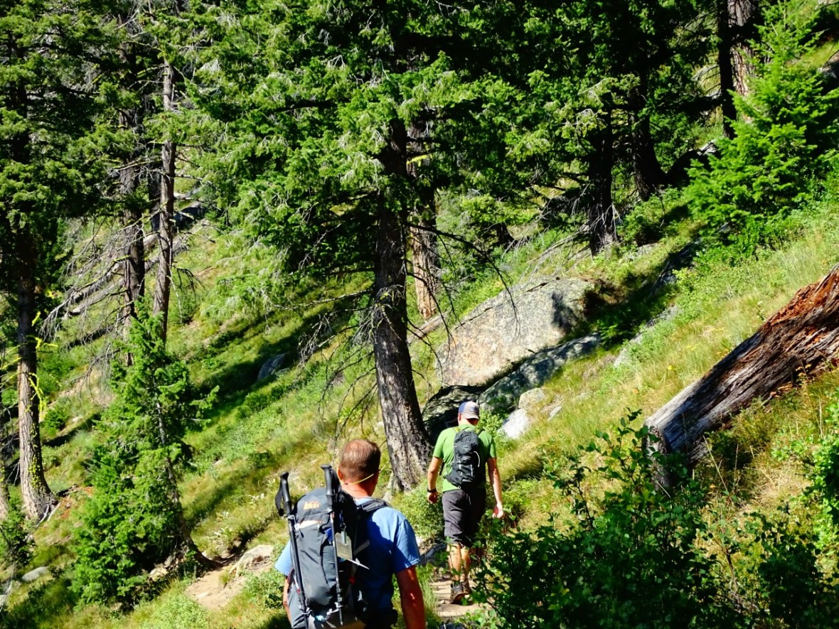
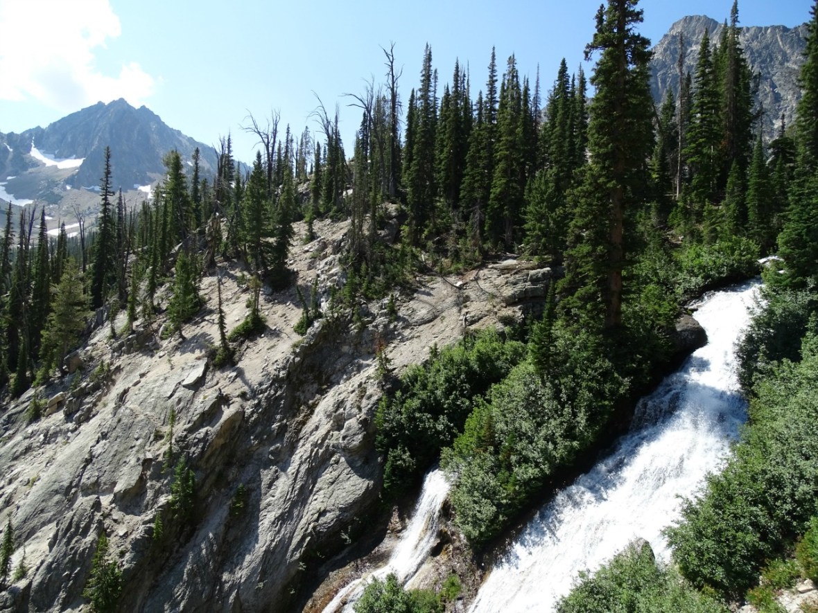
Continue on over a small bridge and the climb will soon start. A couple switch backs and some stunning views. Really, don’t forget to stop and take a moment to appreciate it.
")
")
At the next junction make sure to take a right. This junction is not labeled, so take a right and keep heading up. The first climb you have is over at this point. It’s a steady uphill climb, so here you will have some level ground and to let your lungs recover. However, you will have the harder climb coming up, so take advantage of this part.
Just under half a mile you will reach the area where some will tell you that you can find an easy spot to see the waterfall. We found this to be incorrect. If you head down a sketchy trail to the left you can get to a separate lake that is very small (you can see it as you keep climbing to Goat Lake.). Other than that, you don’t get the waterfall until you start heading up.
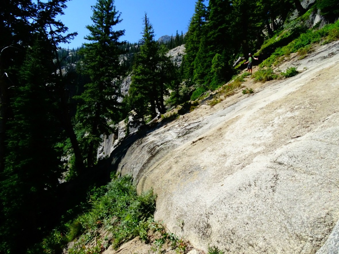
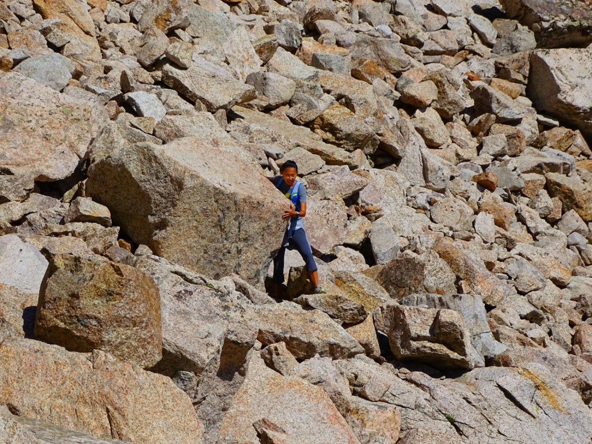
Once you get to this point this wall will be on your right. This doesn’t look to bad, but it’s steep without footholds or anything to grab. We back tracked just a couple feet and climbed along the edge and that is how we should have gotten back down but it was a bit slippery even with hiking boots. Just remember you will have to get back down. This is how we decided the easiest and safest way to do it.
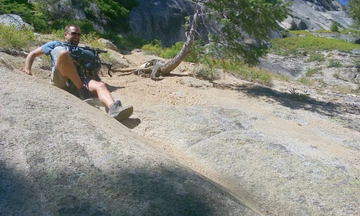
Again, don’t forget to check the view from this point, while you are watching a friend attempt to get up. It really will put you on all fours!

Now, this is where the hardest part of the hike is. It’s steep and over loose scree. your thighs will be screaming and your lungs feeling the elevation.
Remember the lake mentioned earlier? Here is the view after we hiked a little ways up.
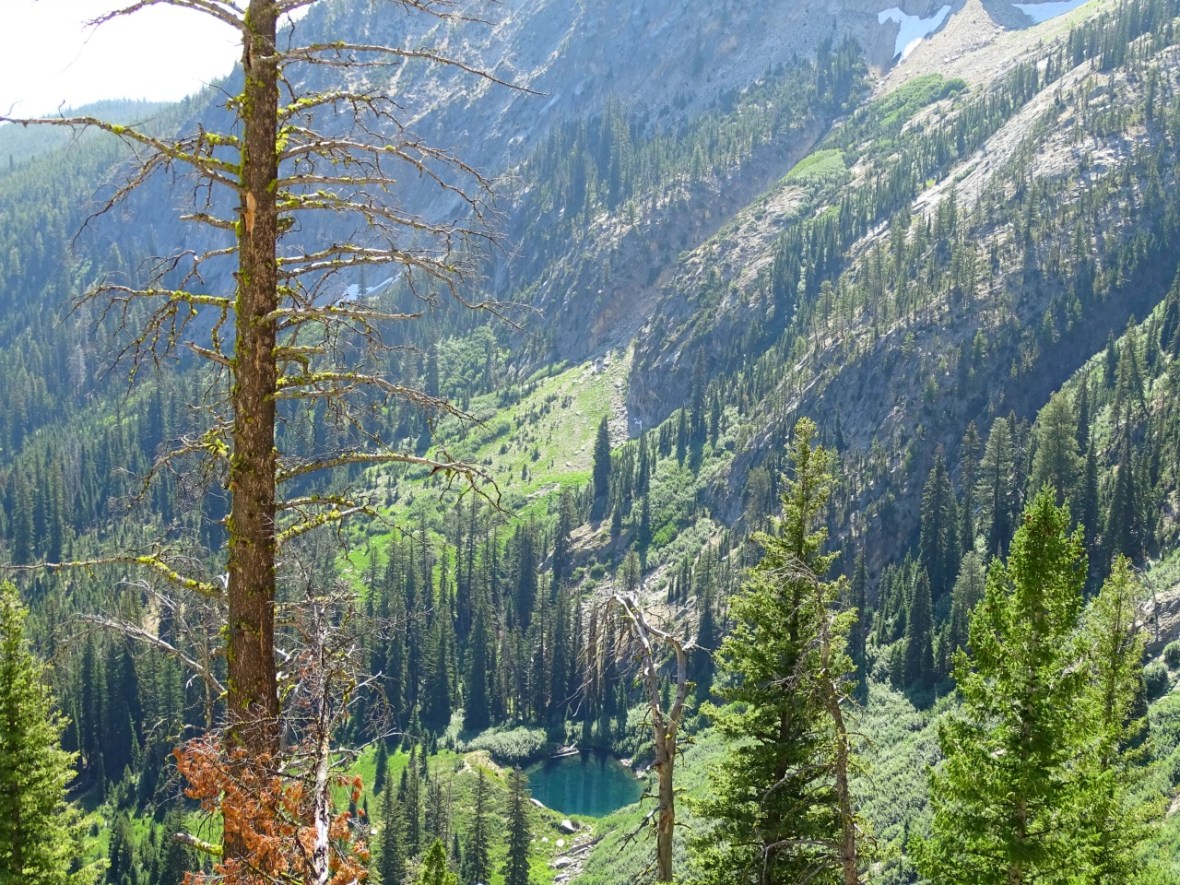
Shortly after this view is where you are able to walk 100 feet off the trail to the left and get to a beautiful view point for the waterfalls.
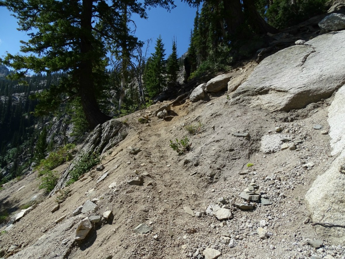
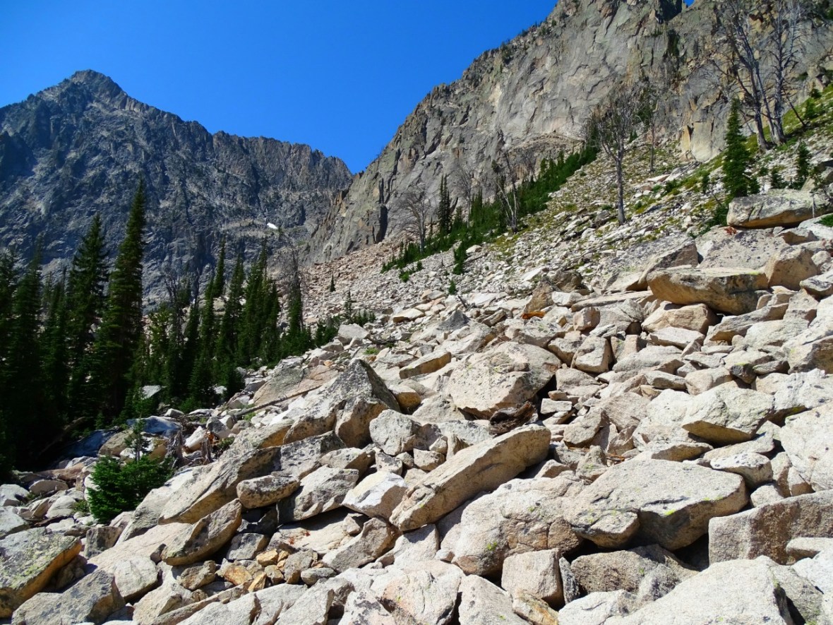
You are not far now from climbing over rock. There is no trail once you get to the rocks, but just head up and to the left.
Just keep climbing towards the line of trees and the lake is just on the other side. I would suggest putting a marker where you started the rock climbing to make it easier on your way back to find the trail.
Once you get close to the trees you will get your first glimpse of the lake. You kind of think it never is going to appear and then the bluest of blue waters does!
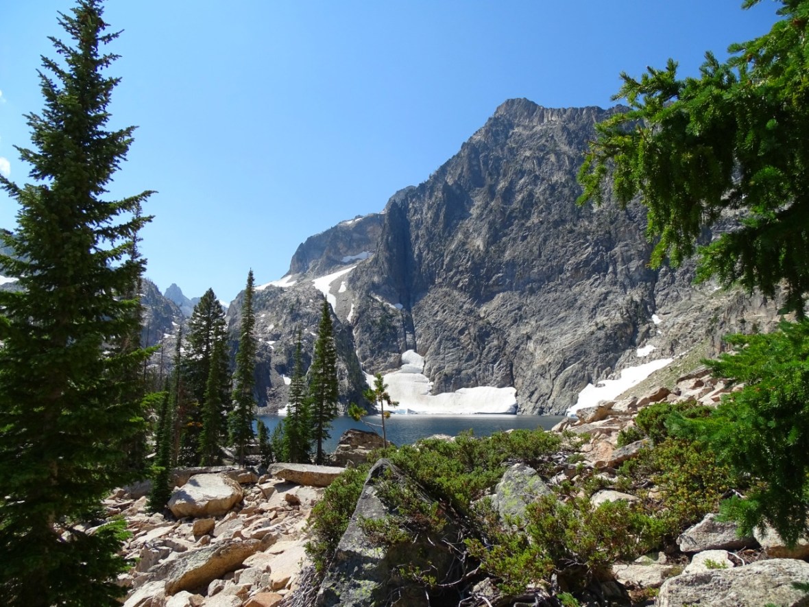
I don’t really know what I was expecting from the lake. I think I was more after the challenge of doing and finding the lake. Other than being a little tired from the climb, all I could do was sit down when I saw it. I keep thinking that nothing else can surprise me on this trip, nothing else can make me speechless. We have seen a lot of beautiful places and I learn that I cannot take anything for granted. I sat there for awhile and just got lost in the view.
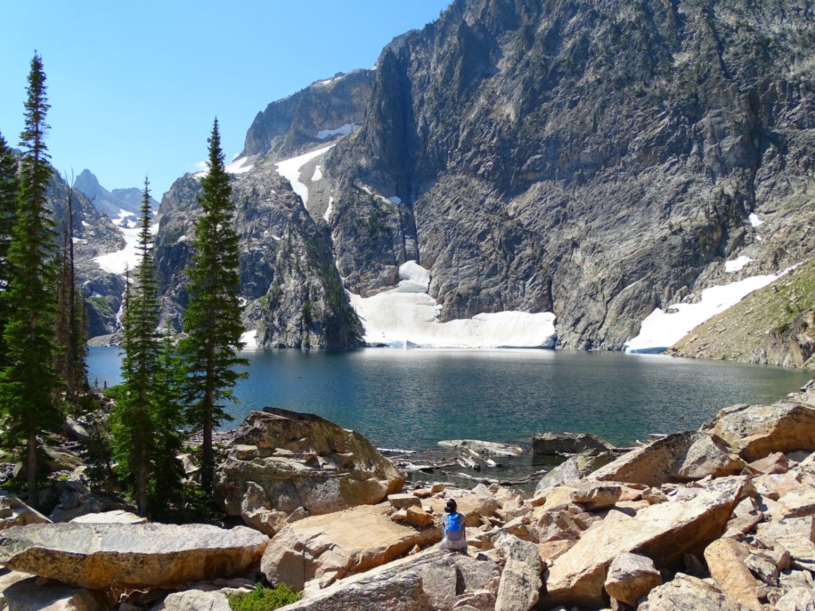
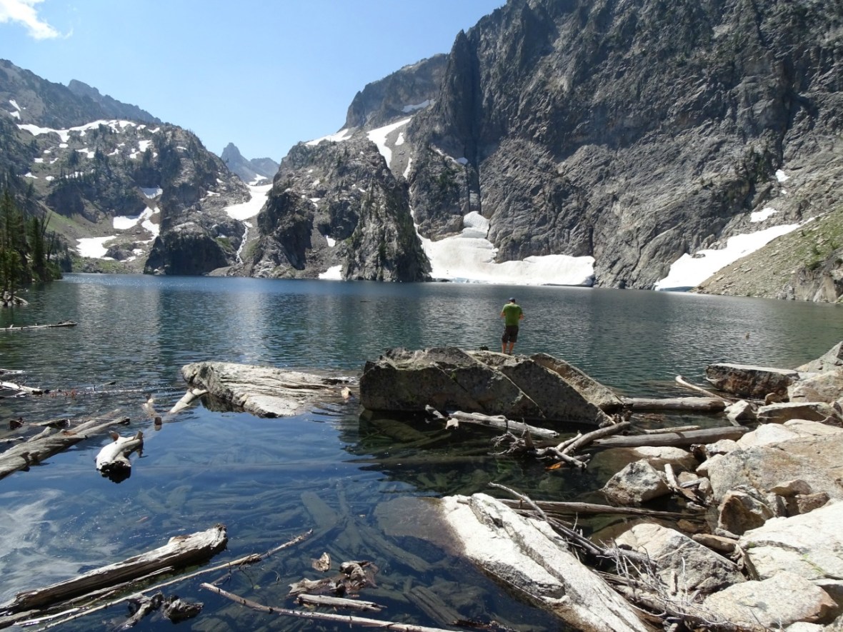
We saw a couple tenters and we could see why they made the trek up here. They had the area to themselves. It was drastically quieter than Alpine and Sawtooth. They had the views of the mountains, the clean lake and the sound of the waterfall all to themselves. The water was definitely cold, you could see the run off from the mountains and the snow across the lake.
")
")
So much snow and it’s August! I am not used to it, I am used to 100 degrees and dry and so this was something out of this world to me. I could have stayed for days and days and days.
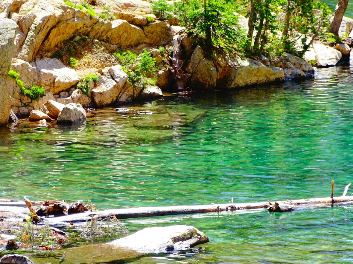
Bold and crazy enough to take a dip? Head to the clearest and most beautiful water.
We had the best day with our friends Jase and Lauri (www.wanderwasi.com). They were the first people we met on the road and they have become good friends. This was our second hike of the year with them (the previous being in Arizona) and we loved every minute.

Thanks to Jase for the drone shot!
This ended up being one of our favorite hikes in Idaho. I was blown away by the beauty, the challenge and the destination. I really couldn’t believe that this was here. Who would have known that Idaho could offer this much. I can’t wait to get back and do it again and maybe stay overnight.
Easy Directions to Goat Lake
Take a screen shot of this as it will definitely help with getting to the lake!
1.1 – You enter the National Forest.
1.4 – You will come to a labeled junction. Take a left.
1.6 – There is an easy creek crossing.
1.75 – Cross a small bridge.
3.2 – You will come to another labeled junction. Take a right.
3.6 miles you will come to a rock wall on your right and what looks like a path to your left. This is where you have to find a way to climb up the rock wall.
4.2-4.5 – You will reach Goat Lake.
Getting to Goat Lake Trailhead
This hike starts at the Iron Creek Trailhead off of Iron Creek Road or FR 619. Turn off of Hwy 21 and it’s an easy drive to the trail head. Gravel, but well maintained. Again, there is a decent size parking lot, but I would not bring anything larger than a van to park there. Don’t forget your free permit!
Parking Lot Coordinates: 44.198649, -115.013719
From Stanley it’s about a 15 minute drive. From Ketchum (Sun Valley) it’s about an hour and 15 minutes.
I do suggest if you can, to stay at one of the campgrounds and then check out Alpine and Sawtooth Lake the next day. Around 10 miles round trip, it is again, a beautiful hike to a much larger lake. Also, this trail is dog friendly, but they must be on a leash and please pick up after them. I was so happy to not find any dog poop or trash on the trail or any of the camp areas.
If this was your hike for the day check out one of these places for a bite to eat and/or a beer!
Stanley – Papa Brunee’s: 37 Ace of Diamonds St, Stanley, ID 83278
Ketchum – Sawtooth Brewery: 631 Warm Springs Rd, Ketchum, ID 83340
Let me know if you did this hike and how you liked it!
Love to pin, use this one!


Congrats… you hit a great area in Idaho – the Sawtooth Wilderness and the Stanley area. I’ve hiked the Iron Creek Trail up past Alpine Lake and on to Sawtooth Lake.There used to be a glacier up, behind Sawtooth Lake, but I think it melted ( I was there about five yrs ago and no glacier).
And we did just what you suggested -we camped nearby at ‘Hayburn’ Campground overlooking Redfish Lake, which was a great campground with great views of the moon over the lake at night. We spent a few days exploring the area. Glad you enjoyed it! 😉
LikeLiked by 1 person
Having spent the entire month of August camping in the Sawtooths for 10 years in a row, i agree, the scenery is gorgeous. In addition to this trip I HIGHLY recommend going up to 4th of July lake. The photo ops there are as good if not better than this trip. I caught my 1st Golden Trout at this lake. It is WELL worth the trip!!
Forrest Salfen
Temecula, CA
LikeLiked by 1 person
Thanks for the recommendation. It was next on our list but we ran out of time. Next year!!
LikeLike