I still get the itch to be on the open road. The wide open space and the feeling of freedom. So after a long week of work, we packed up the car and headed south for waterfalls. After passing the small towns of La Pine and Gilchrist you take a right and head towards Willamette National Forest. A beautiful forest with lakes, waterfalls and thick Douglas-firs.
I was searching for a hike through the woods and a waterfall. It’s hard to explain the feelings you get being near a waterfall. It’s best experienced for yourself. I feel refreshed, almost rejuvenated and it’s good for the soul. After researching Diamond Creek Falls I was hoping that it would be the one. I am a bit behind in posting, as we did this hike in the spring. Spring is the best because it usually means a raging waterfall, one that you can’t hear the person next to you. Plus the hike to Diamond Creek Falls offered a beautiful easy hike.
Hike to Diamond Creek Falls
Miles: 3.2 R/T ♦ Elevation Gain: 837′ ♦ Trail Type: Loop ♦ Trail: Easy to Moderate
We were worried about the traffic, road and trail. As we were driving through the forest, our worries subsided. We drove with the windows down and the music playing. I couldn’t think of a better moment. With few cars around we were hopeful that it meant we were getting to the trail head early enough.
We arrived to plentiful parking and there were even RV spots. I could only guess how busy this area is in the summer. If you are unable to hike to Diamond Creek Falls, don’t worry, there is a very, very sort walk to Salt Creek Falls. Salt Creek Falls is the third highest plunge waterfall in Oregon (after Multnomah and Watson Falls). At 286 feet it is a sight to see.

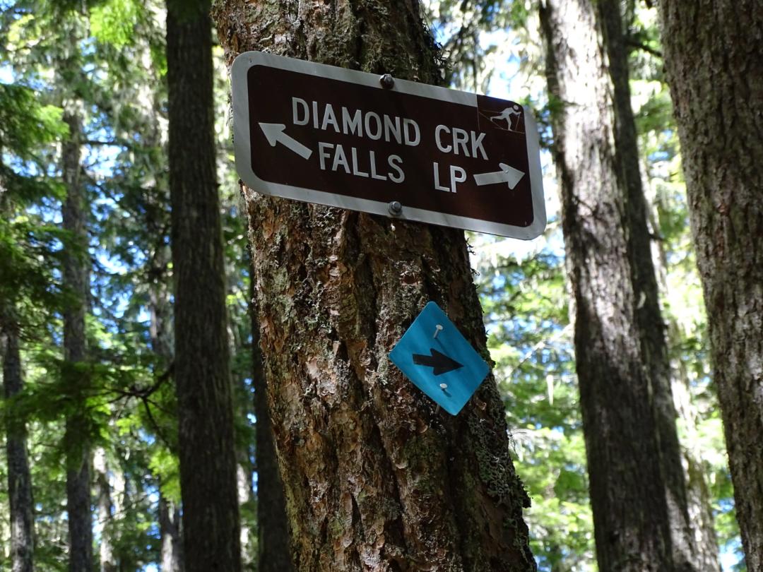
If you decide to continue on, as you are looking at the falls, head left to the trailhead for the hike to Diamond Creek Falls.

Since this post is past the season that we went, don’t worry, it’s great all year long. Spring, summer and fall, will provide a beautiful hike and in the winter it is marked for cross country skiing!
At this point I suggest going right. With a gradual incline it makes the 837′ elevation gain feel minimal.

As you continue on, you will notice that there are multiple view points and a lake (Too Much Bear Lake). The lake is only a quarter mile off the path. With multiple places to either take a break, take a dip in the summer or float, it is worth checking it out. After getting back on the path and continuing on, you’ll enter rhododendron woods and eventually you will see a sign that says lower Diamond Creek Falls, don’t be confused, it is really going to the upper.
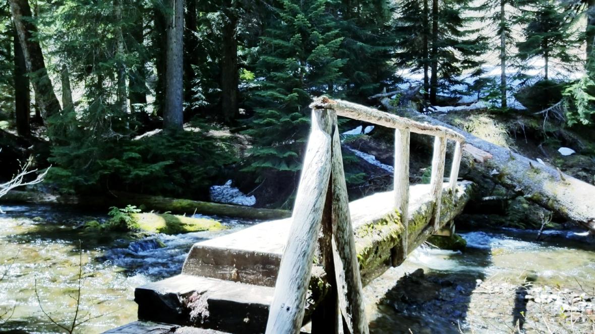
When you reach the log footbridge crossing over Salt Creek you are close.
At this point you can hear the falls. Continue on the shaded path and come to your first glimpse of the falls.
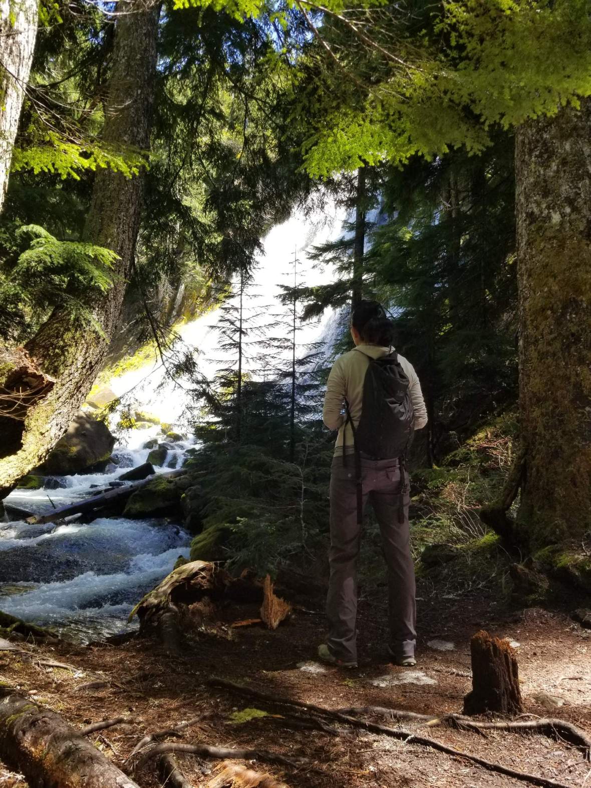
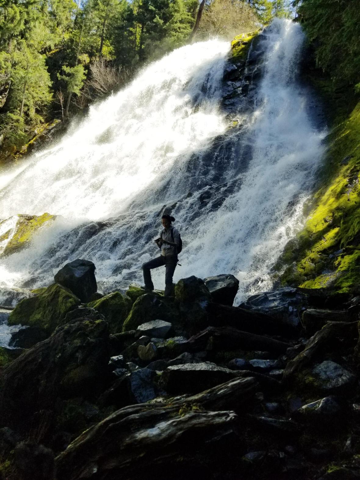
Don’t be afraid to get a little closer, but be careful of the slippery rocks and logs that surround the falls. The green moss covered the rocks where ever they could. The colors are beautiful in the spring. So vibrant. Take the few steps to get a little closer, but please don’t climb.
It truly was just what we needed that weekend. I highly suggest this one as it really is the perfect excursion for the entire family. After you are done enjoying the falls, head back to the main trail to continue on or turn back. We did the entire loop, so we didn’t miss anything this trail had to offer. We considered forging on to Vivian Lake, but we were not prepared for a longer hike. Let us know if you have made it and if we should head back!
Diamond Creek Falls Trail Information
Aside from regular parking, there were about 8 RV parking spots. It really is a great road trip stop!
Dog Friendly: Yes, on a leash
Family Friendly: Yes, very
Parking: 43.611686, -122.127776
Parking Fee: $5
Parking Accepted Passes: Visit the website here.
Best Time: All year
Forest: Williamette National Forest
Other Uses: Spring, Summer and Fall – picnicking, Winter – Skiing
Access: All year
USDA Website for Area Status: Diamond Creek Falls
Packing: Water, poles to help with incline if needed, snacks and hiking shoes
As always, please respect these public areas. LEAVE NO TRACE. Be aware of fire restrictions during the season.
Love to Pin, Use this one!


That waterfall is unbelievable!
LikeLike
The falls seems pretty impressive 🙂
LikeLike