Death Valley National Park is one of the most unique national parks in the United States. What most people don’t realize it is the largest national park in the contiguous United States. This national park had been on our list of national parks for some time but it never seemed to be a priority. We even lived in Southern California for some time, traveled throughout Southern California and we still didn’t make the detour. So on an annual trip to Las Vegas, we made it a priority to at least get a glimpse of what it had to offer and if we wanted, we could always come back. I didn’t have any expectations. Other than knowing we could make it to the lowest spot in the United States. A crazy 282′ below sea level, this previous sea floor is now a beautiful white salt flat.
We read multiple blogs about what to see and figured out how to make an itinerary for just a day. Believe me it was hard, but in the end, we were happy with what we saw and can’t wait to get back.
The Best Day Trip Itinerary for Death Valley National Park
Known as the lowest, hottest and driest national park. This means it is best visited in the winter and early spring. The record high in Death Valley is 134 degrees. As recent as August 16, 2020 the high hit a crazy 129.9 degrees. So if you are venturing there in summer, make sure to be prepared. While there are services within the national park, come prepared just in case they are not able to assist.
If you only have a day and a short time to visit what shouldn’t you miss. This is our suggestion for a day in Death Valley National Park.
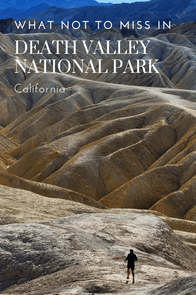
Zabriskie Point
Zabriskie Point makes it on a lot of people’s lists of places to see in the national park, but not a lot put much emphasis on it, even with it being one of the most photographed spots in the park. I thought it was incredible. It has one of the most amazing views I have ever seen. I didn’t want to leave. You have a view of the Black Mountains and then in front, hills and gullies with vibrant yellows and shadows, which makes for incredible views.

Take some time to explore the area. You are still allowed to climb and walk around to get a closer look. There is a parking lot and restrooms here.
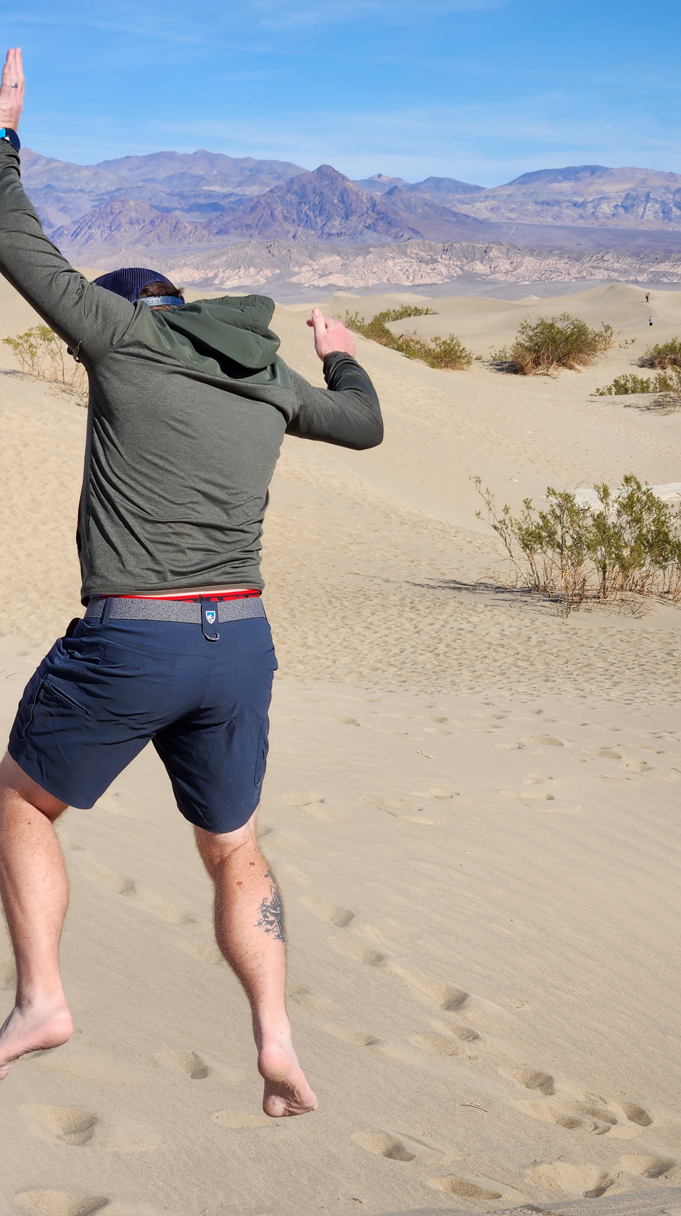
Mesquite Flat Sand Dunes
Your next stop is Mesquite Flat Sand Dunes. Bring a sled and take off your shoes and have fun sledding and running around these dunes. Since it is a national park there are no vehicles allowed and so you are free to roam without the fear of getting side swiped. If you are into photography, they say to get here early in the morning so you can capture the dark shadows and bright colors of the sand at the same time. You can capture individual ripples in the dunes and the temperatures are definitely more preferred at those times.
Stovepipe Wells
So after these two stops it will probably be time for an early lunch. Head to Stovepipe Wells and grab a burger at the Badwater Saloon. There is also hotel, campground, market, gas station restaurant and gift shop. If you do have time make a stop, check out Mosaic Canyon.
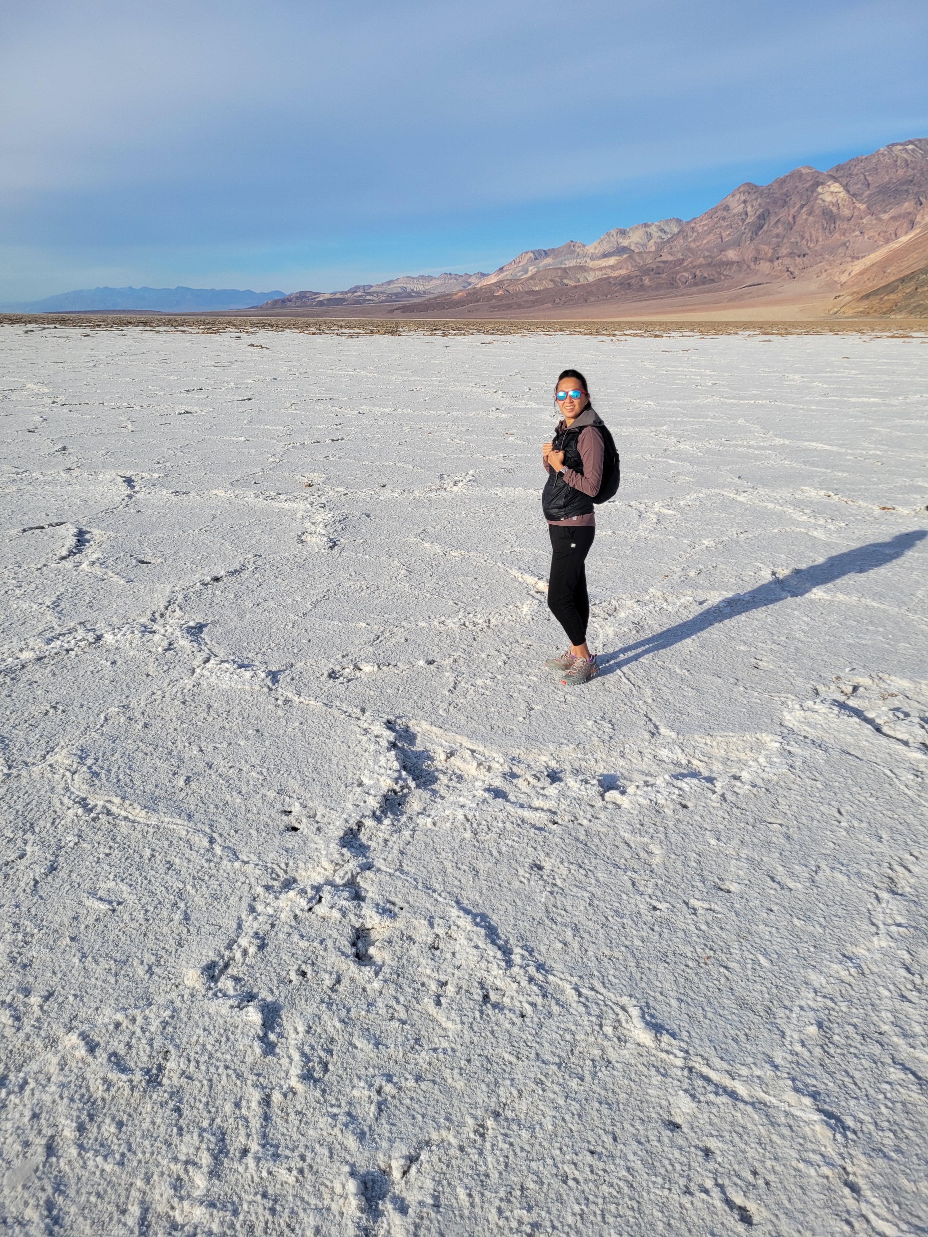
Badwater Basin
This is what Death Valley Park is known for. The endorheic basin (got that from google) that has the lowest point in the United States at 282 feet below sea level. You are walking on an old sea floor. This area only started to become what we see it today 11,700 years ago. Going from a water abundant place to the hottest place on earth. There is a large parking lot and parking along the road to walk on the salt flats. Take the short quarter mile walk to the flats and take in the area. It is not recommended to venture too far out because the area is unpredictable. If you are up for it and have more time there is a golf course just north on Badwater Rd that you can play at!
After Badwater Basin you will head back north. We didn’t have time, but on our list of places to see was Natural Bridge Trail. If you have time, or you decide to cut something else out, we would suggest checking this area out.
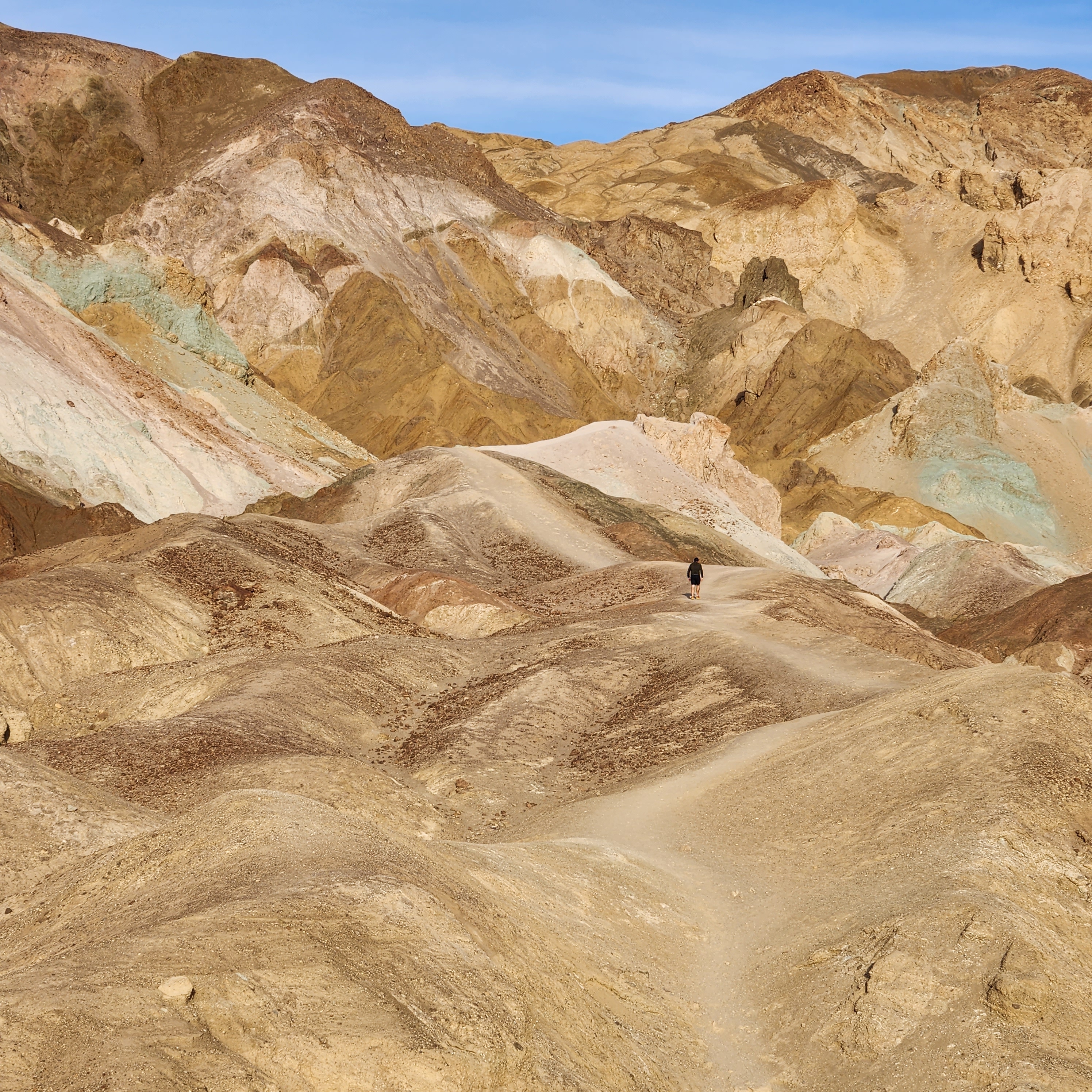
Artist’s Palette
After Badwater Basin we headed to Artist’s Palette. This area and Badwater Basin were my top spots on my list. Located on a one way 13 mile turn off from Badwater Road, it will take you to an area full of mud hills, small slot canyons and some incredible multicolored rocks on a mountain side. With a clear view point and an access point to get closer it is a must see. It is said it is better seen in the evening at sunset when the sun highlights the colors more. We made it mid afternoon and it was still beautiful and this is probably how you will see it. A lot of photographers enhance the colors or edit them. But to the blind eye, this is what you will witness when you get there.
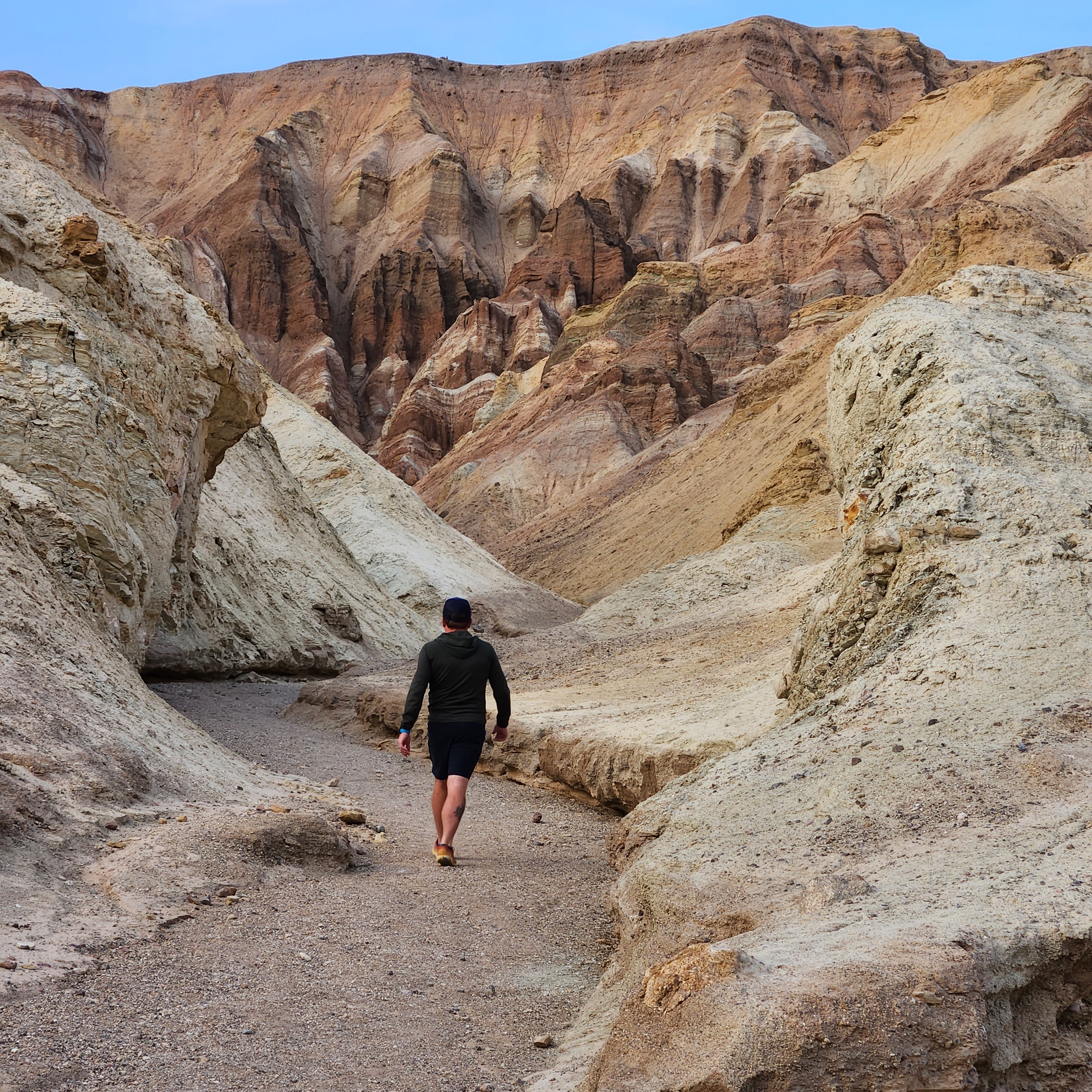
Golden Canyon
Our last stop and a now MUST SEE on our list is Golden Canyon. This is a great spot for everyone at any level. You can either do the 3 mile round trip hike to Red Cathedral or the 6.5 mile loop trail that will take you back to Zabriskie Point. As a reminder, during the winter it will get dark here around 4:30 pm and the temperature drops. We had plenty to do exploring within a couple miles of the trailhead.
What We Missed
There are so many more incredible spots to checkout. The spots that we didn’t make it to were: Ubehebe Crater, Dante’s View, Keane Wonder Mine, Natural Bridge, Mosaic Canyon and Rhyolite Ghost Town. There are actually 5 ghost towns in the national park.
We would have loved to have been able to golf as well, but time didn’t permit. We are still so happy with what we got to see because it definitely made us want to get back asap.
If you plan it right one of the most popular things to do in Death Valley National Park is to check out a bloom during the Wildflower Season. What is even rarer of an event is the Superbloom. The last two superblooms happened in 2005 and 2016. The park explodes with beautiful flowers of all colors. Instead of a dry desert, it looks like a Pacific North West field of flowers.
Things To Know Before You Go
There is a fee for exploring the National Park. Vehicle is $30, Motorcycle is $25.00, Bike/Foot $15. Death Valley Annual Pass is $55. If you have the America the Beautiful, US Military, Veterans, Access Pass and Senior Pass allows you to enter for free.
As a reminder there are no dogs on any of the trails. If you are exploring in the summer it is best to not even bring them and if they are with you and you let them out, I highly suggest booties.
There are no drones allowed.
Make sure to check out the website before you go for road closures, weather and basic information: https://www.nps.gov/deva/planyourvisit/index.htm
Please remember to Leave No Trace. This is a remote area and services are only in certain areas. If you bring it in, take it out.
Love to Pin, Use This One


Titus Canyon has to be on the list of must sees, though it is a dirt road drive. It does not require 4 wheel drive or high clearance, but be careful as a few spots are rough. Still, it can reasonably be done with a standard car if you drive carefully. The Park takes the conservative position of 2wd high clearance recommended, which is prudent since most people have no experience with rougher roads. The Racetrack is another great destination but time consuming to get to and return. (also 2wd high clearance per Park recommendations, but are a little bit better overall). There is another very nice dirt road that continues from Teakettle Junction over Hunter Mountain to Hwy 190 west of Panimant Valley near the west entrance. This road is also 2wd high clearance per Park recommendations, but it is very remote so do it only if you know how to drive on such roads.
LikeLiked by 1 person
Thank you so much for these recommendations and helpful information! I will add these to the top of our list for the next time we go.
LikeLike
Great post! Sorry you missed Rhyolite. My son and I checked it out and loved it.
LikeLike
Thank you. We will definitely be back in the area and Rhyolite is first on the list.
Thank you for the recommendation!
LikeLike