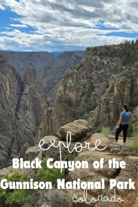
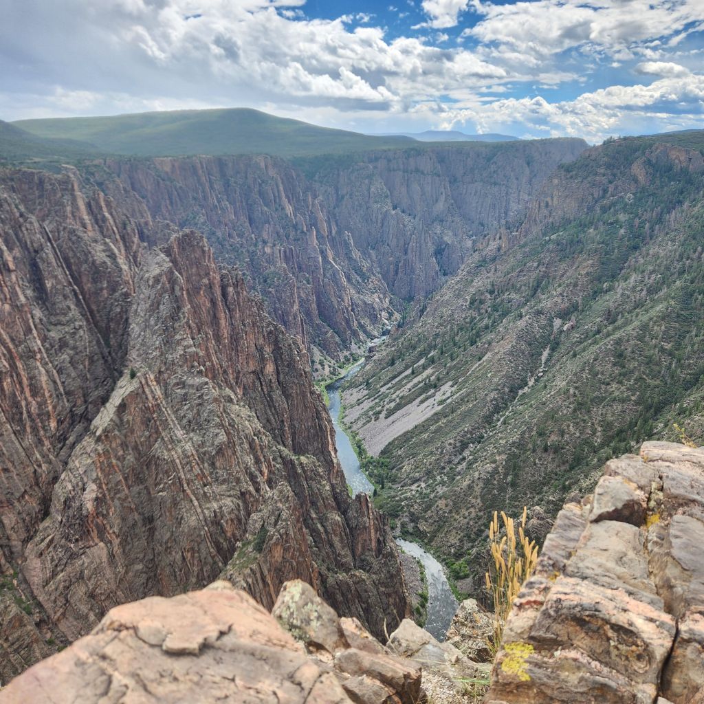
Black Canyon of the Gunnison National Park is a national park that takes some planning to get to. We have been trying for years to get to it, but it never worked out. Located in western Colorado, the closest town is Montrose. If you are not from the area, you may have never heard of the town. A small town of about 25,000, it is the gateway to the most unsuspecting canyon. You can’t even see this 1,800′ deep, 48 mile (14 miles in national park) canyon until you are right there. Hidden by scrub brush and century old junipers, it will provide a jaw dropping view the moment you see it. Then think…the structure of the canyon was started 2 billion years ago. Yes 2 billion and the river that you see today started cutting through the canyon walls 2 million years ago. A truly inspiring canyon!
Getting to Black Canyon of the Gunnison National Park
To get to the north rim entrance you take highway 50 north out of town to highway 92 south. The entrance lies along highway 92, and will take you about an hour and a half to get to the North Rim Ranger Station where your exploring begins. With limited services, make sure to remember everything you need.
Since there is no bridge, it can take up to around 3 hours to get from the north rim to the south rim. You will have to go back to Montrose to then go to the south rim.
To get to the south rim, you take highway 50 south out of town and then a left onto highway 347. It is about 15 miles away from downtown Montrose to the south rim visitor center.
A few reminders to explore Black Canyon of the Gunnison National Park safely!
Practice Leave No Trace.
Do not approach or feed ANY wildlife.
Keep dogs leashed and only in designated areas. Check at one of the visitor centers or online if you are unsure.
Bring plenty of water when the weather is hot.
The rim is at 8,000′ so be aware of the elevation and potential altitude sickness.
Exploring Black Canyon of the Gunnison National Park
There is not a lot to do at this national park if you compare it to some of the other national parks like Arches or Yosemite. What you do get is a very accessible national park to all ages and all abilities. You can either explore the south rim, north rim or do both if you have the time as they do have a campground at both the north and south rim. This will allow you to take advantage of the night sky. It has one of the darkest in the United States and believe it or not, some flora and fauna need it to survive.
There is access to the river from the East Portal Road at the south rim. A very steep road to the canyon floor, you can camp and it is a great spot for fishing. There are also a few hiking permits that are given out to people who want to experience a primitive unmarked hike from the south rim to the canyon floor. The inner canyon is designated as wildnerness. This means you need a permit to climb, hike, kayak, or fish, pretty much anything. Dogs are not allowed. Dogs are allowed, leashed, at overlooks along the rim and on very few trails.
Most people choose to do a scenic drive, or e-bike from one of the campgrounds. The roads are narrow so be careful if you walk or bike. There are short hikes at almost all the view points and enough parking for a van. A few overlooks only have a small pull off for about 6 cars or less if there are vans. I would not tow either scenic drive as there isn’t always parking for large vehicles and usually only one spot to turn around.
We were able to explore the south rim along the scenic drive before the rain came and it was such a great experience. So make sure to check the weather since this area is known for those afternoon thunderstorms!
Here are our favorite spots to make sure to stop at on your journey of the south rim of the Black Canyon of the Gunnison National Park.
Tomichi Point
You will reach Tomichi Point before the visitor center. Get a sneak peak of what awaits you on this adventure. You can either snap a pic at the overlook and meet one of the volunteers who will tell you what you need to know or this is the start of one of the longer hikes on the south rim. You can hike to the visitor center and a few other stops from the Rim Rock Trail to the Uplands Trail to the Oak Flat Loop Trail. None of them are long or strenuous.

Pulpit Rock
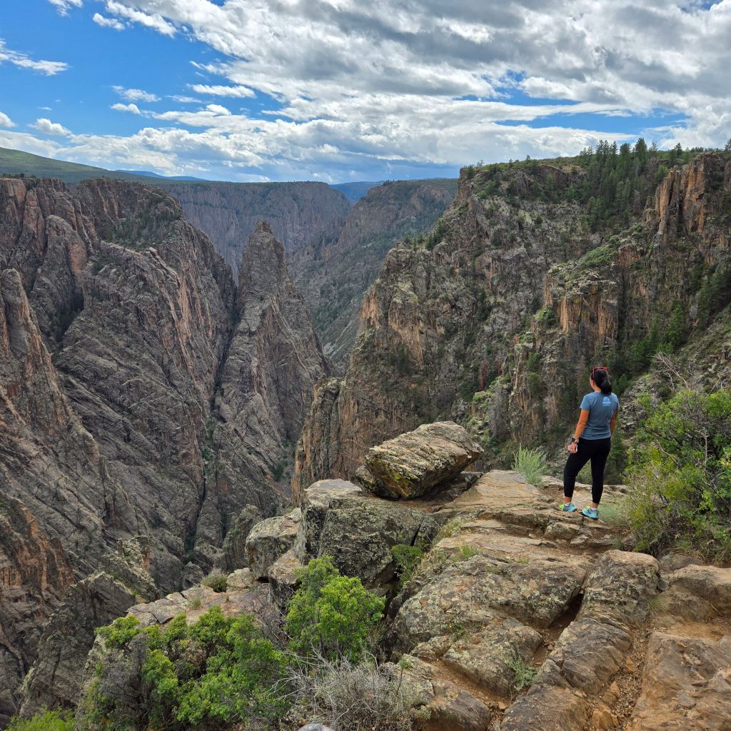
Being at some of these overlooks reminded me of my fear of heights. Very steep drop offs and some of the areas do not have guard rails or fences to stop people from getting close. You can even hear the river running below, so it is quite a powerful moment.
Cross Fissures View
This was about as close as I would get and there was even still only a short drop below. Looking through this canyon is so incredible. It would be amazing if you could hike the length at the canyon floor.
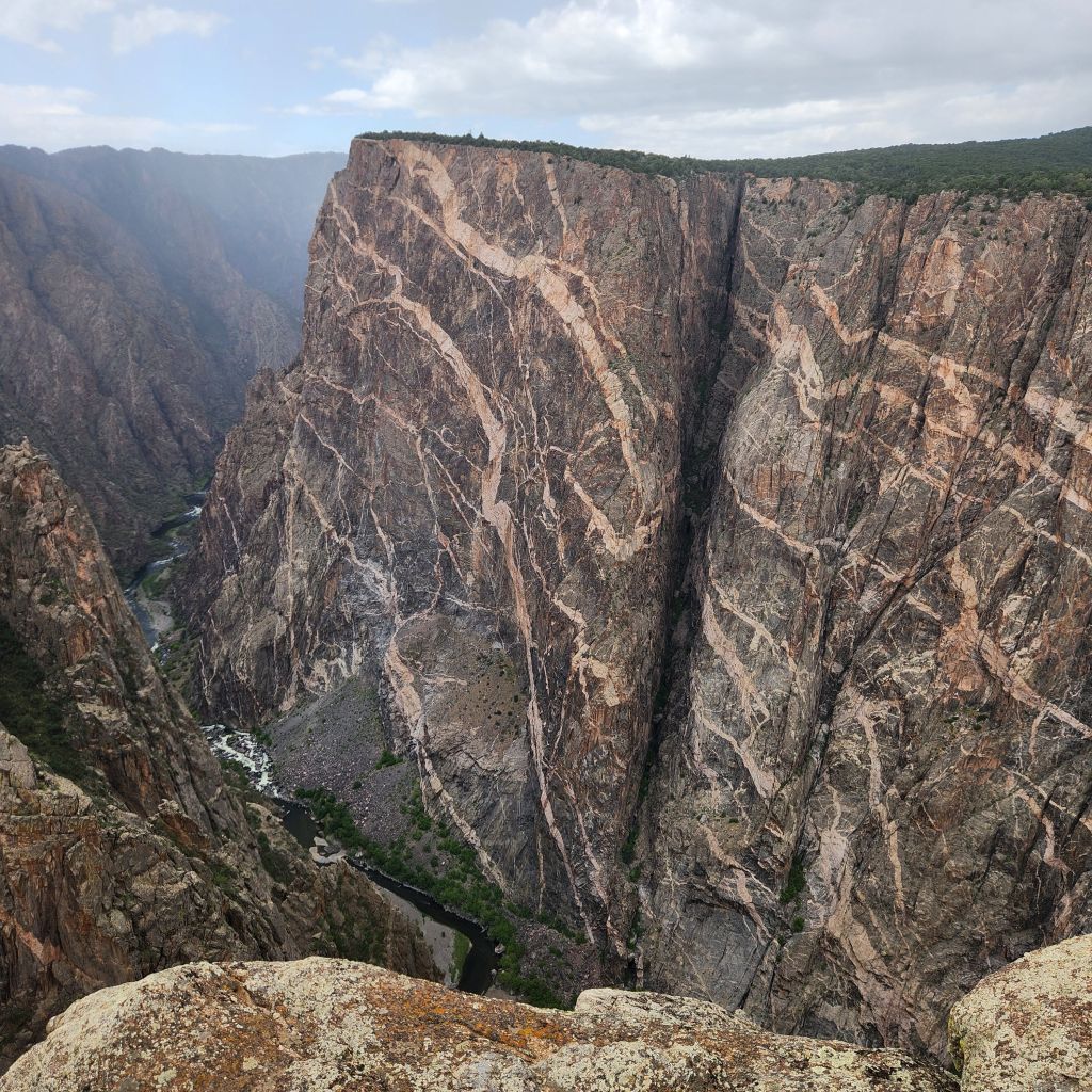
Painted Wall
This was probably my favorite stop. It was quite popular and you can see why. I find it quite interesting that I probably learned about some of this stuff in school and it didn’t really interest me. Now, as an adult, something that I would have never believe, I am so interested in learning and reading the signs at these places. It is kind of inline with my obsession with river cruises. Anyways, the painted wall is made up of layered Pegmatite and Gneiss rock. Educational and informative. There was a little more educational above about the night sky. My mom would be so proud! But seriously, it is quite amazing learning about this and seeing it in person. Pictures are great but being surrounded by the sounds of the area while taking in the views is like nothing else.
Sunset View
The moody clouds ruined the sunset view for us but it was the deepest we could see into the canyon. You then wonder, “why did the river not just cut through the canyon in a straight line?” Some more research that will need to be done. It really makes you wonder and then just sit there in amazement.

Warner Point
This is the last point and the second longest hike on the south rim that you don’t need a permit. There are bathrooms, plenty of car parking, 4 RV spots that cars like to park in for some reason (why do people do this, especially when there are car spots available) and it is where you can turn around if you are a bigger rig and haven’t been able to yet. Unfortunately we got here when it was full cloud coverage and so we didn’t see anything.
Follow along to see where we are going next!
Love to Pin, use this one!